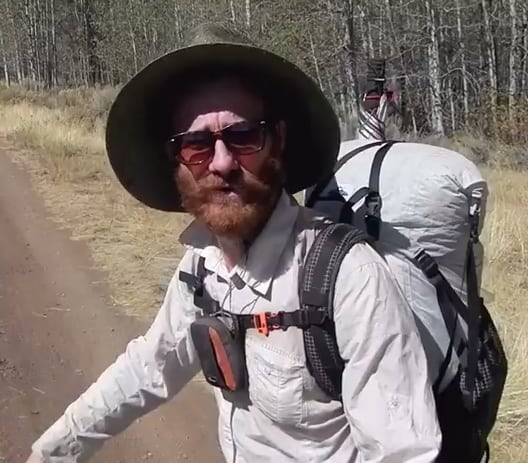
The Oregon Desert Trail’s first fall thru-hiker, Bob “Huck Finn” Jessee, completed the route in 2015. Read about his adventure and tips for getting out in the shoulder season.
The Oregon Desert Trail (ODT) may have been Bob “Huck Finn” Jessee’s second thru-hike, but following his successful 2013 completion of the 3,000-mile Continental Divide Trail, the newer and shorter trail offered a lot of the same challenges: navigation, distances between water sources and difficult terrain.
“I like hiking in the off-season,” Bob explained, “and fall was the timeframe it worked out for me to hike the trail.” No matter that he didn’t find any resources outlining what he could expect on a shoulder season hike in eastern Oregon; being the first to tackle a route like the Oregon Desert Trail has its challenges, and Bob was up for the task. On top of issues like unreliable water sources and the possibility of inclement weather, he upped the ante by using only map and compass to hike the new route.
“I think the adventure is more of a reward on a route like the Oregon Desert Trail,” Bob explained. “I don’t use a gps or any technology, so to be able to do it with a map and compass is really rewarding when you find you are on track … but I was quick to discover that it didn’t really matter if you were on the track or not. You can hike it as you want, as long as you [stay on public land]. Unlike other trails [like the Pacific Crest Trail or Appalachian Trail] I wasn’t bound by trail markers because there are none.”
As the route was envisioned as a primitive and remote backcountry experience, of the 750-miles, over 30 percent consists of cross-country terrain and over 50 percent can be found on old two-track roads. Instead of building trail, the idea was to connect into the existing infrastructure already on the ground, and since a lot of the desert consists of sagebrush seas, hikers can easily take a bearing and cross distances that would be challenging in a forested landscape.
Because 2015 was a dry year in the desert, Bob found he needed to carry lots of water at times, and by lots, he means almost 20 pounds! “In the first section I cached water in pretty standard spots [based off where previous ODT hikers cached],” he explained, “but north of Paisley I carried 9 liters because I didn’t have a car to cache in the middle … my base weight was about 13 pounds, so food and water made up most of the weight.”
Another challenge came in the form of difficult tread. “The terrain is far more rugged than people would expect it to be,” he commented. “I joked that this can’t be a scenic trail because you can’t look up … at times there is lots of lava rock under your feet, and you need to pay attention to your steps. It’s not a grassy knoll as it might look like from afar.”
The rewards, though, were many. “The highlights of the hike were discovering things not in the trail materials,” he explained. “When I was walking on Abert Rim I saw a note on the map near a lake that said ‘petroglyphs.’ I found a whole wall of cool petroglyphs that weren’t mentioned in the guidebook; it seemed in the most natural spot on the lake for them.”
“I wouldn’t suggest hiking from east to west to just end in Bend,” Bob commented, “because hiking east means you end in the Owyhee Canyonlands. I tried not to look at pictures too much before the hike; if you don’t have an idea of what the Owyhee will be like, it’s just mindboggling. The rock is so interesting, and I really enjoyed the deeper section [in the Little West Owyhee] where you have to take your pack off and swim. Even in fall you have to swim. I was wet for 2 ½ days straight … it’s hard: There’s boulder hopping, and it’s cold, but it’s an awesome adventure. I would go do that just for a weekend!”
When asked what advice he would give to hikers wanting to get out in the fall he suggested:
1) Really consider your water: I feel comfortable carrying up to 9 liters, maybe because I’m bullheaded, but I probably would have been more comfortable if I had cached more water.
2) If you want to see a lot of wildlife, spring may be a better season to hike: I think I missed out on a good portion of the wildlife because it was so dry.
3) Be ready for cooler weather: The weather was cool; my hottest day was in the beginning of September (95 degrees) on the Diablo Rim, and I had only one day of rain.
3) It’s more rugged than you think it’s going to be.
4) Hunting season considerations: Once you get to Plush many of the places to stay will be full because of hunting season, or they will have closed for the season. Steens Mountain and the Pueblos were inundated with hunters; you didn’t see them on the trail or in a cross-country section, but any time you hit a dirt road there were ATVs nonstop.
5) Carry hunting maps: I carried hunting maps in a few sections, and they are really good at showing the private property lines, and more dirt roads that the USGS map didn’t have. (Note: the smartphone app onXROAM is a gps-enabled program that shows private property too.)
“The Oregon Desert Trail is a pretty intense, and it’s not for your average hiker,” Bob explained. “I would definitely do this trail again because it’s super unique, it’s accessible, and you would have a totally different experience depending on the time of year.”
Note: Bob’s hike in 2015 was a much dryer season than this 2016 fall has proved to be. Many of the water sources Bob noted as dry in our water report were in fact running.