Beatys Butte Fenceline Monitoring
success
Spring Basin Wilderness
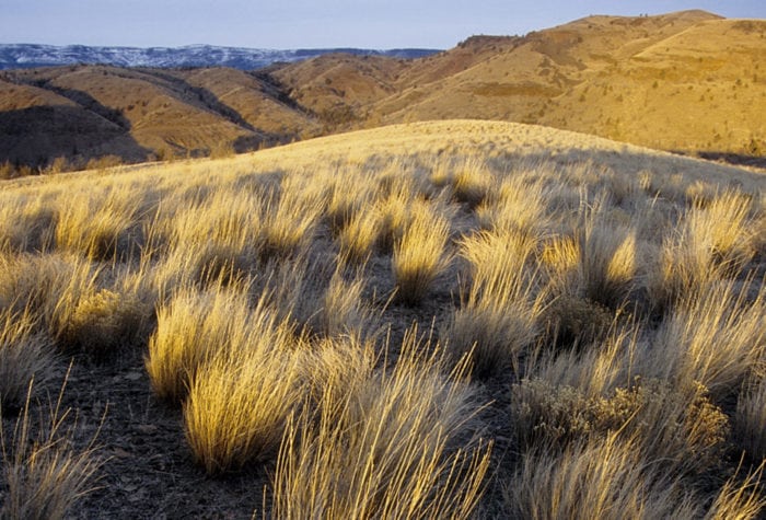
Spring Basin Wilderness
Spring Basin Wilderness
With 10,000 acres of undulating terrain, secluded canyons and spectacular vantages of the John Day Country, Spring Basin is magnificent to explore This public treasure, forever protected as Wilderness, offers a profusion of desert wildflowers in the spring and year-round recreational opportunities for hikers, horseback
Read Morevoices
Aaron Tani, Sage Society Member
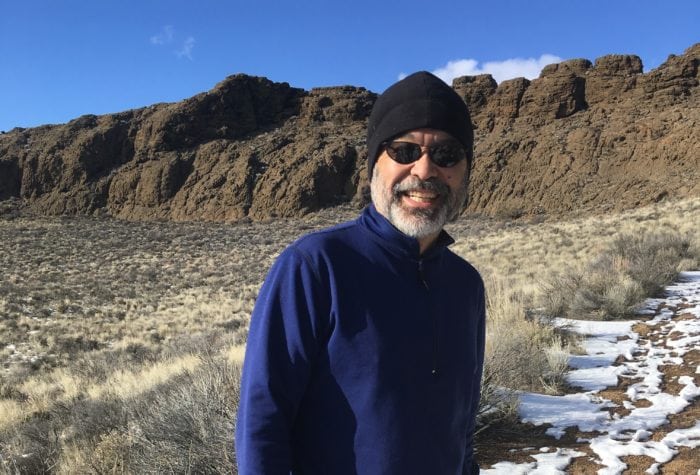
Aaron Tani, Sage Society Member
“It feels good to support ONDA on a monthly basis, because I know they never stop supporting our public lands. ONDA works to help make our lands a better place for the future, and I feel like I’m a part of that every month with my support.”
fact
Bitteroot
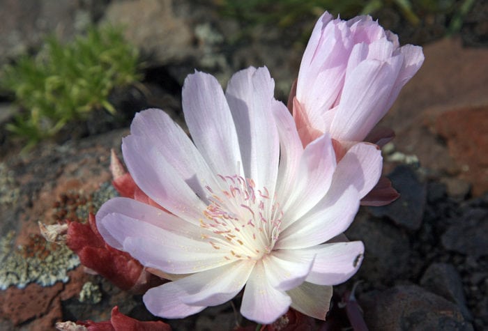
Bitteroot
Bitteroot blooms on north-facing cliffs in western North America.
The Paiute name for bitteroot is kangedya. Traditional Native American uses of the plant included eating the roots, mixed with berries and meat, and using the roots to treat sore throats.
Organizer: Stewardship Team
Project Timeline: 3/01/2022 through 10/31/2022
Region: Hart Sheldon Region
Difficulty Rating: Level 3: Challenging
Volunteers Needed: No limit
About the place
The Beatys Butte region includes an area of traditional aboriginal use by the Burns Paiute Tribe. The Tribe has a small reservation in Harney County, located near Burns; the Burns Paiute People are the descendants of the Northern Paiute, or Wadatika people. After being forced to leave their lands following the Bannock War, members of the Burns Paiute tribe returned and reestablished their community in the Harney Valley. The Wadatika’s homeland encompasses a territory from the Cascades east past what is now Boise, and from the Columbia south well into Nevada. Learn more about The Burns Paiute Tribe here.
Beatys Butte is an integral part of the “land between” Hart and Sheldon National Wildlife Refuge in BLM’s Lakeview District south-central Oregon. Explore ONDA’s Greater Hart-Sheldon Storymap to learn more about this region. The Beatys Butte allotment is 575,495 acres in total, 506,985 acres of which are public land. The area on and around the Beatys Butte Allotment supports a variety of wildlife and includes winter and migratory habitat for pronghorn antelope, and habitat for sage grouse, pygmy rabbits, western big-eared bats, ferruginous hawks, burrowing owls, desert and short-horned lizards, and other mammals and birds.
Almost 80% of the allotment overlaps the Beatys Butte Sagebrush Focal Area, one of the six most important areas identified by the U.S. Fish and Wildlife Service for the long-term survival of the Greater sage-grouse. Beatys Butte provides both important migration corridors and critical year-round habitat for the regional pronghorn population.
Barbed wire fences present throughout the allotment pose risks to wildlife. Low flying sage grouse are known to become entangled in standing fence, while pronghorn and other ungulates may be unable to cross the fence, limiting both their daily movement and seasonal migrations. With the results of our mapping efforts, we will be able to identify obsolete fences that can be removed and functional fences that can be retrofitted to mitigate some of the hazards they pose to wildlife.
About the stewardship work
This project will build on past volunteer fence mapping efforts and will help us identify the location and condition of fences on the Beatys Butte allotment. The monitoring will involve driving your vehicle to access different sections of fence in the area, day-hiking along identified fence lines, using your smart phone or device to take geolocated photos, and completing digital survey forms of fence conditions. Be prepared to hike between 2-6+ miles per day, often on uneven terrain.
This is a photo monitoring project
- Drive to the section of fence you choose to monitor.
- Hike along the fence, taking photos, notes and recording data digitally.
Timing
This project can be conducted year round, although spring and fall may be the most comfortable times to be out. Be mindful of traveling off the loop road after heavy rains and during fire season. We ask volunteers who sign up for this project to make at least one monitoring trip in 2022 for a minimum of 4 hours.
Difficulty
This trip will require hiking on uneven terrain for 2-6+ miles, navigating in a remote setting, and driving on maintained and unmaintained gravel roads.
Registration
An ONDA registration application and medical form are required for this project.
Project Details
All the information you will need to know about this independent project will be emailed to you when you register. Each project page has extensive information about access, technology, tools, maps and more. Please be prepared to spend 1-2 hours reviewing this information prior to heading out on your project, the good news is that time spent reviewing and preparing for your trip all counts towards your volunteer hours.