Pine Creek Conservation Area Restoration (KEEN)
Organizer: Ben Gordon
Start Date: 9/17/2019
End Date: 9/20/2019
Region: John Day River Basin
Difficulty Rating: 3 out of 5
Maximum Group Size: 12 participants
About the place
Pine Creek Conservation Area (PCCA) is located on the John Day River near Clarno. It is approximately 35,000 acres in size and surrounds Spring Basin Wilderness on three sides. The property itself was purchased over the course of several years by the Bonneville Power Administration (BPA) beginning in the late 1990s to mitigate for the impacts of the John Day Dam on the Columbia River. The Confederated Tribes of Warm Springs now manage PCCA, with BPA funding, for the benefit of fish and wildlife.
Pine Creek is a tributary of the John Day River, and runs for over 10 miles through PCCA. It is home to steelhead and a growing colony of beavers.
ONDA volunteers have been actively contributing to conservation projects at PCCA for over a decade. They have planted tens of thousands of riparian trees, removed nearly 100 miles of obsolete barbed wire fence, cleared juniper from riparian areas, conducted monitoring, and built Beaver Dam Analogues.
View the map.
About the stewardship work
Western Juniper has been expanding throughout much of its range. The rapid increase has many land managers concerned about the health of the sagebrush-grassland habitat  because juniper can displace many of the shrubs and grasses that provide forage to wildlife and at-risk species such as sage-grouse. Junipers also cause problems for many watersheds because they can consume large amounts of water as compared to other shrubs or grasses.
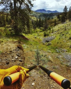
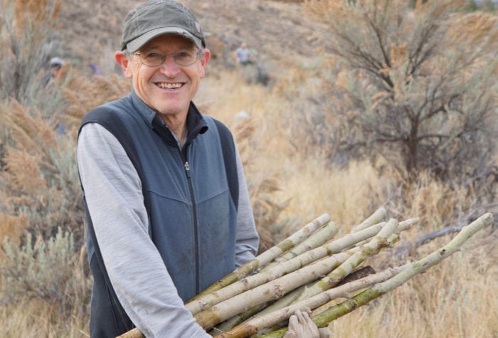
ONDA volunteers will spend the week removing the recent increase in young junipers near Robinson Creek. The work will involve using loppers and handsaws to cut the junipers at the base of the tree. It can be difficult, hot, scratchy, and challenging, but it feels good to look back at the end of the day and see a healthier rangeland.
Trip timeline
- Tuesday, Sept. 17 (5:00 p.m.): Volunteers should plan to arrive in the evening with enough time to set up camp and spend some time talking about the week ahead.
- Wednesday, Sept. 18: After breakfast, we will walk to the worksite on Robinson Creek to begin our first day of juniper removal. Volunteers should plan to be out all day and be prepared for a full day of walking, kneeling and doing physical work in weather that could be hot and dry.
- Thursday, Sept. 19: Another day of juniper work. Plan to be out from about 8 a.m. to 4 p.m.
- Friday, Sept. 20: After breakfast the group will be free to head home or spend some additional time exploring the expansive property that we will be working on.
Camp
This trip will involve car camping at an undeveloped campsite behind a locked gate on the PCCA property. ONDA will provide a porta-potty. There will be no potable water source, but a creek is present on-site for washing water. There will be plenty of room to spread out in terms of tent sites, but we will gather in the evenings and the mornings to be able to share information about the work and for some social time. The campsite is accessible in a standard vehicle; no 4WD required.
Difficulty
The work will require walking approximately two miles each day, kneeling down to cut junipers, and carrying a daypack with food, water and ample clothing to stay warm and dry in variable conditions.Trip highlights and challenges
Participant responsibilities
Participants are responsible for their own food and camping gear as well as transportation to and from the trip (don’t forget your camp chair!). ONDA will bring water, but it is a good idea to supplement our supply with a few gallons from home. In the event of sunny and hot weather, please bring up to four liters of water capacity for the day, and consider an electrolyte replacement drink or mix to help you stay hydrated. Sturdy off-trail ankle-high boots, long pants, a long sleeve shirt (a lightweight sun shirt is a great option), and eye protection are required for this trip (sunglasses or prescription eyeglasses are suitable eye protection). Participants should be prepared to be away from camp all day and bring a daypack for lunch, snacks, and water.
Gear provided
ONDA will provide tools for the work, work gloves, and sunscreen. We will bring some group camping equipment (shade tent, tables for cooking, wash bins for kitchen cleanup, a privy), some potable water, expert leadership, and we can talk about some of the important restoration projects within the John Day River basin.
Registration
An ONDA registration application and medical form are required for this trip. Check the box next to each trip you would like to attend. You only need to fill this form out once per year.
Apply Now
What happens next?
You will receive a confirmation email within 10 working days of submitting your form. The confirmation email will provide information regarding which trips you are on the “participant list” for, and which trips are full, and therefore you have been placed on the “waitlist.”
Six weeks before the start of the trip, the trip leader will send out an RSVP to make sure everyone is still able to participate. Based on RSVPs, open spaces will be backfilled with people from the waitlist.
Three weeks before the trip start date, registered and confirmed participants will receive driving instructions, maps, carpooling options, and additional information in an email sent by the trip leader
If you have any questions in the meantime, please don’t hesitate to contact the trip leader.
This trip will be led by ONDA's Stewardship Director, Ben Gordon. For questions about the trip call (541) 330-2638 ext. 309 or email ben@onda.org.
Meet BenONDA's Restoration and Stewardship Work
Over the last two decades, ONDA has engaged volunteers in projects to plant thousands of trees, restore dozens of miles of streams, decommission old roads, and remove enough barbed wire […]
Read More