ONDA Oregon Desert Trail Coordinator Renee Patrick shares a “water alternate” option to the hiking route on the Chewaucan River. She likes to say, “rivers are trails too” and hopes others are inspired to view our desert landscapes from a different angle.
The remote landscapes of eastern Oregon are often best explored on foot, away from the highway, and where one can be immersed in the scale and magnitude of the high desert. However there are certain special spots across the map where one can float, paddle, or drift through the folds and pockets of our arid landscape on desert rivers. Many of these waterways can be elusive in dry years, and may only hold enough water to boat in a period of spring snowmelt.
Four such rivers can be found along the Oregon Desert Trail (ODT) corridor: the Chewaucan River, Donner und Blitzen River, West Little Owyhee River, and Owyhee River. These waterways offer a different perspective and way to experience sections of the route that can vary drastically from a hike in the same area.
 A few years ago on a backpacking trip in the Fremont National Forest I drove along the roadside section of the Chewaucan River (Section 7 of the ODT), noting its potential for a packrafting adventure. The following year a heavy rain in February led to many of the rivers around Oregon reaching flood stages, and the idea of paddling the Chewaucan popped up in my mind. Many rivers have gauges that record the rate of water flow (Cubic Feet per Second or CFS), and that data is publicly available. Avid boaters watch these water flows closely, especially for desert rivers, so they know where to go and what to expect. The Chewaucan does not have a gauge, so it can be a guessing game if there will be enough water. My boyfriend and I saw the flooding trend across the state and decided the chances were good that the Chewaucan could be paddled.
Looking at a map, I could see a network of Forest Service roads crisscrossing around the river corridor upstream of where the paved road (FS330) leaves the water, so Kirk and I decided to park and hike our boats upstream, about 10 miles above the town of Paisley. Upon further inspection I saw one could drive up and over Moss Pass and access the river about 20 miles upstream from Paisley. While this would extend your river adventure another 10 miles, it’s important to note there are patches of private land along this stretch and boaters will need to be aware of where it is appropriate to land or camp.
As some of this area is open to grazing, we encountered several barbed-wire fences crossing the water, a hazard if a paddler isn’t paying attention, but we found we could easily duck under these barriers.
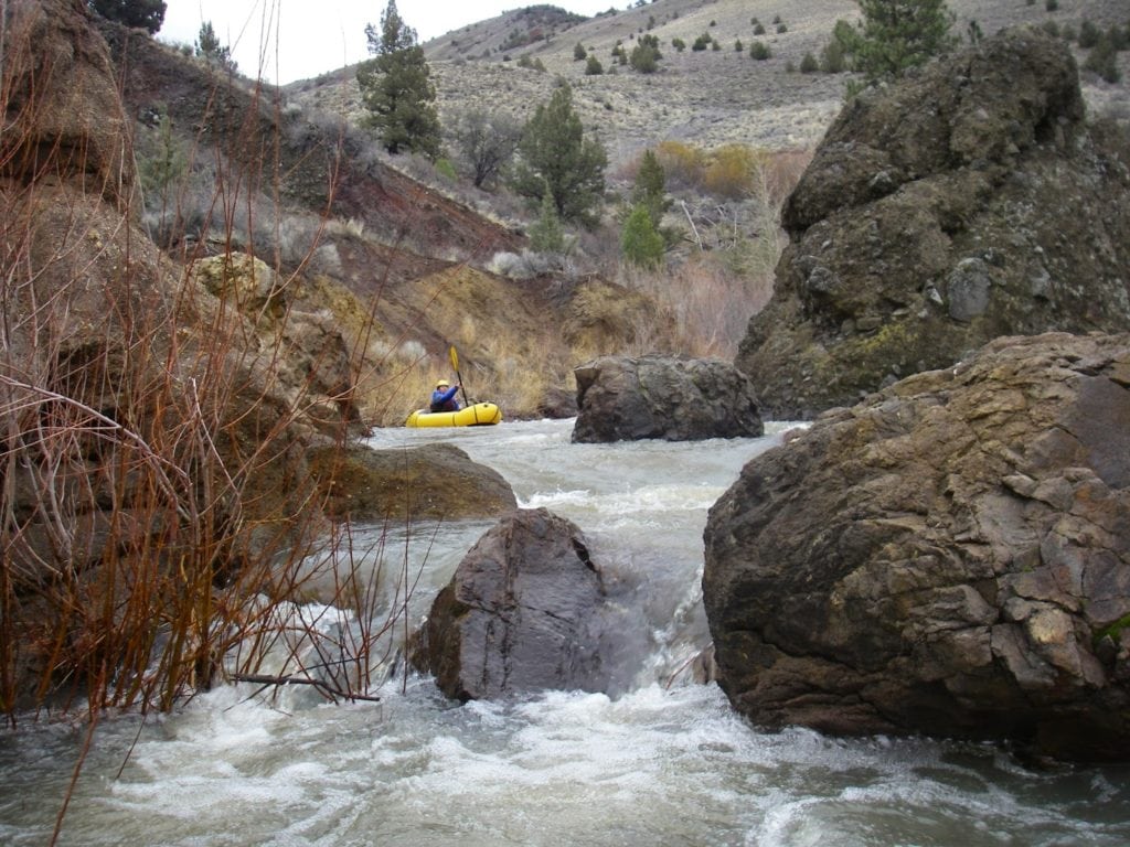
The water was splashy and the flows made for a fun Class II section in our boats. And the fish! While we didn’t bring our fishing gear, red band rainbow and brown trout can be found darting in the deeper pools.
We made camp at the Chewaucan Crossing, a quiet and free campsite along the river, and also the spot where the Oregon Desert Trail crosses the water as it heads up to the ridge-tops of the Fremont National Forest. The rushing river made for a comforting background soundtrack to the early February evening and we warmed up around a fire as the light dimmed into night.
The next day we could see the water level had dropped some, but there was still plenty to continue our float another 5 miles. Most of the Chewaucan is roadside, but the character of the river takes on a completely different feel at water level. The layers of rock reveal a glimpse into the area’s geological past, and it is easy to forget the pavement a short distance away.
If you don’t happen to time your trip right for a boating adventure on the Chewaucan, make sure to come back in the heat of the summer when the flows are lower, and reveal some excellent swimming holes!