One of Oregon’s 58 officially designated Wild and Scenic Rivers.
Located in southeastern Oregon and reaching across the corner of Idaho to its headwaters in northeastern Nevada, 35 percent of the Owyhee River within Oregon has been classified as “Wild and Scenic” for its recreational, wildlife, geologic and cultural values.
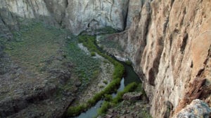
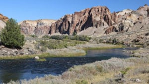
Cutting through benches of the Owyhee Canyonlands formed by volcanic activity and erosion in the remote and primitive environment of southeastern Oregon, the river has served as an oasis for people and wildlife since prehistoric times. Indigenous people have inhabited and used the Owyhee for millennia and archaeologists have recorded hundreds of sites with cultural importance in the region.
Today, the Owyhee Canyonlands provide home for a variety of raptors. Swainson’s, ferruginous, red-tailed and sharp-shinned hawks, as well as American kestrels, northern harriers, prairie falcon and golden eagles are abundant year-round while bald eagles generally spend winter months in the canyons. Songbirds, mourning doves, chukar partridge, California quail and even the greater sage-grouse are drawn to the mixed sagebrush along the upland banks of the river.
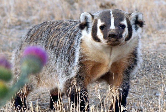
Mammals range in size from California bighorn sheep, mule deer, pronghorn antelopes, bobcats and cougars to smaller coyotes, badgers, otters, raccoons, porcupines, and jack and cotton-tail rabbits. The presence of these species and others keep the Owyhee River wild and scenic and now draw in visitors who want to behold them and their majestic home.
Visiting the Owyhee River offers outstanding recreation all around. Photography, rafting, kayaking, hiking, nature study, fishing and camping are just some of your options. The area is scenic and unspoiled, offering white waters and serene calmer pools, mysterious side canyons and towering spires.
By Kelly Sprague