Author: Renee Patrick | Published: November 10, 2023
This article originally appeared in the Fall + Winter 2023 Desert Ramblings
Hiking for a plan to permanently protect this landscape.
When I pitched my tent on the edge of the lumbering Sutton Mountain, the views were obscured by heavy rain clouds. My dry island of nylon was an escape from the drenching spring rains, and while I lamented missing out on the scenic vista that was buried in layers of hazy moisture, I knew a good soaking rain was something to encourage and even celebrate in this desert landscape. Some bright bloom or newborn babe would grow an extra inch in this wet, and for that I was grateful.
Luckily enough, my optimism for a dry morning and relief from the low-lying clouds was realized, and when I zipped open the tent fly the next day, the world revealed itself. I could see the brilliant Painted Hills, fresh and vibrant as if the rain dialed the hues up a notch, and beyond, in layers of ridgelines, sat the far reaches of the Ochoco Mountains…with a dusting of fresh snow! Even though I was backpacking in early May, winter’s grip lingered.
I celebrated the views, one: because I would be able to hike the edge of this fault block sentinel and enjoy the unique vantage point that the ancient geology and plate tectonics provided, and two: because I would be ending my exploratory nine-day backpacking trip through the John Day River Basin on a high note. Hiking up and over Sutton Mountain was to be the grand finale.
What is it to know the land? To our hiking hearts, it is to walk through it, to sleep between stands of bunchgrass, to drink from elusive desert springs, and climb up to rocky bluffs only previously traversed by bighorn sheep. Folks fortunate enough to spend time in this area become intimate with the plants, animals, geology, and human history unique to the area. We come to understand the importance of the largest intact expanse of federal public lands in the John Day River Basin, and why it needs to be permanently protected, with Sutton Mountain as the pinnacle of these lands.
I prepared for this hike by printing out pages of text to read in the evenings when my legs wouldn’t cooperate after 15 miles of walking up and down the steep (so steep) terrain along the John Day River. I had information on geology, history, public lands, and even a little poetry. I wanted bits of inspiration and intrigue to help me understand the place I was walking through. I wanted information that would help illustrate why the John Day River basin was so important, and places like Sutton Mountain, so unique.
And what did I learn?
Geologically speaking, I had to imagine myself standing here millions of years ago when this landscape was being buried by ash, lava, and volcanic mud, solidifying and preserving ancient plants and animals.
Ecologically speaking, I learned that Sutton Mountain was the nexus of important migration patterns of elegant creatures like the Rocky Mountain elk, sleek pronghorn antelope, and the nimble mule deer. Above, equally intricate patterns emerge from winged fauna drafting in the air currents; golden eagles and ferruginous hawks soar, while sage sparrows and red-naped sapsuckers flit in the wooded brush below.
Culturally speaking, I was walking through the original homelands of the Warm Springs Tribes and the Northern Paiute peoples, homelands that probably appeared much as they did thousands of years ago, for this area, in particular Sutton Mountain, hasn’t been disrupted by extractive industries, expansive development, or intrusive management. Sutton Mountain is as it has been, and that is why permanent protection for this area is so important: so it stays that way.
Each year, hundreds of thousands of visitors travel to the Painted Hills National Monument just across the road from Sutton Mountain. In fact, the iconic painted hills don’t end at the monument’s boundary. If we step back into the imagination machine when I watched layers of ash and basalt build into the hulking ridgeline of Sutton Mountain, those compounding layers would also resemble the colorful neighbor across the street, as the lower reaches of the mountain continue to reveal.
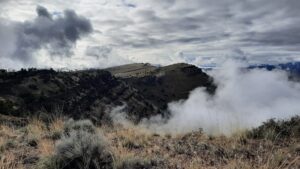
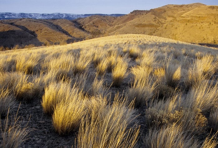
If visitors turned around to consider Sutton Mountain as their next destination, they would find more than just a stunning backdrop, they would find secluded valleys, rolling grassy hills, and outcrops of impressive volcanic rock…all the things I love to explore on a hiking trip into this special area. But without more consideration and planning, it is easy to imagine the destruction that unmanaged recreation or development could bring and already has to nearby desert destinations. That is why a thoughtful and inclusive plan to permanently protect Sutton Mountain will be so important. It is through improved conservation management that we can sustain the values that make a hike here today, and in 100 years, so compelling.
I think the wonderful thing about visiting Sutton Mountain is that much is left to the imagination. This is a place prime for following your curiosity as very few established trails will tell you where to go. Instead, you can ramble at will, and if you keep the values of ecological diversity, intact habitats, and respect for cultural, historic, and local communities in mind, recreating with respect and intention can be in harmony with this place and its future.
I invite you to climb up to the rolling grasslands of Sutton Mountain’s flank, walk the edge of the dramatic fault, and when you arrive at the 4,700-foot summit, picture what this place will look like in a few hundred years. You won’t have to imagine it, it will look like this.
