Author: Anne White | Published: July 7, 2022 | Category: In the News
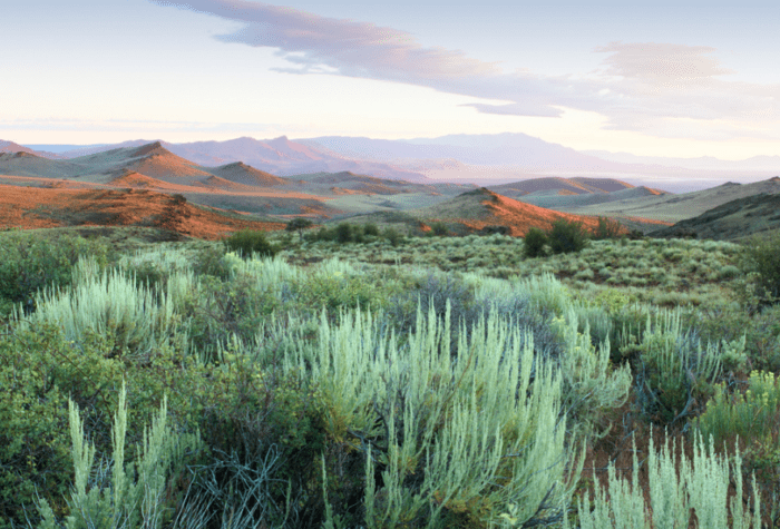
In the far southeastern corner of Oregon lies an undulating sagebrush sea peppered with native wildflowers, carved by numerous willow-lined streams and surrounded by the Oregon Canyon Mountains to the north and the Trout Creek Mountains to the west.
Sage-grouse congregate at leks (breeding grounds) across the area, imperiled Lahontan cutthroat trout reside in the cool high-elevation streams, pronghorn browse on abundant bunchgrasses and wildflowers during the summer, and mule deer find refuge and forage during the cold winter months.
The place: McDermitt Creek, in the northern extent of the ancient McDermitt Caldera that overlaps the Oregon-Nevada border.
The site might also become North America’s largest lithium mine.
voices
Carl Axelsen, member since 1999
Carl Axelsen, member since 1999
You folks at ONDA really have your stuff together. Such a well-planned opportunity to comment, since figuring out how to connect with the gummint is off-putting. You make it work for me.
This healthy, intact sagebrush steppe is teeming with native forbs, bunchgrasses and shrubs, essential to stately mule deer, iconic pronghorn, and diminutive sagebrush lizards. California bighorn sheep are found on the southern slopes of the Oregon Canyon Mountains to the northwest, within eyesight of the proposed mine. Golden eagles nest nearby. Altogether, hundreds of species of flora and fauna depend on increasingly rare sagebrush habitats like that potentially threatened by mining at McDermitt Creek.
Greater sage-grouse. Photo: Devlin Holloway
Importantly, this entire landscape is recognized by both the state of Oregon and the Bureau of Land Management as irreplaceable habitat for greater sage-grouse, among the best remaining in the West. The population in this Sagebrush Focal Area—habitat that supports the most productive and dense sage-grouse populations—contains some of the highest sage-grouse numbers in the state.
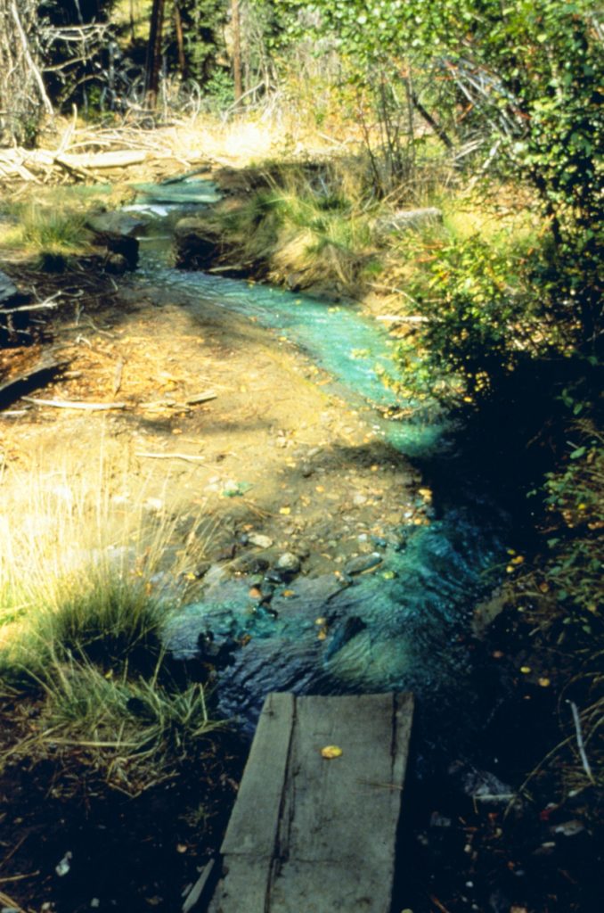
Numerous streams, including McDermitt Creek, also flow through the area and provide vitally important habitat to Lahontan cutthroat trout, a threatened species which has been federally listed since 1970. Since the 1990s, federal and state agencies and partner organizations have undertaken restoration and recovery efforts to establish a metapopulation in the watershed, which is the only location capable of supporting a resilient and diverse population in the larger management unit that spans Nevada and Oregon.
Lahontan cutthroat trout. Photo: USFWS
In recognition of the rich ecological values in this watershed and the importance of McDermitt Creek to the protection of Lahontan cutthroat trout, Western Rivers Conservancy recently purchased the 3,345-acre Disaster Peak Ranch as a refuge for the fish. Their long-term goal is to facilitate the restoration and recovery of this imperiled species throughout more than 55 miles of creek in the watershed, including many segments that we now know may lie within the boundary of the potential future lithium mine.
The McDermitt Creek area also lies within traditional lands of the Burns Paiute Tribe, Fort McDermitt Paiute and Shoshone Tribes, the Shoshone-Paiute Tribes of the Duck Valley Indian Reservation, and the Confederated Tribes of Warm Springs.
And, the area appears to contains very high concentrations of lithium.
What We Don’t Know
Jindalee Resources, an Australian mineral exploration company with claims across 9,050 acres on both sides of McDermitt Creek, is currently conducting exploratory drilling to determine the extent of the lithium deposits and their concentrations. Development of a mine is years into the future and we don’t yet know what the mining plans might look like. But, Jindalee Resources has described the project as “an absolute monster,” suggesting their vision for this landscape might include a massive industrial mining complex in McDermitt Creek.
Although we cannot yet know what might be proposed or what the specific impacts may be to fish, wildlife, water and habitat, we can begin to consider the potential impact of mining in McDermitt Creek by looking at other mines across the west.
The Asarco-Mission Complex, Twin Buttes, and Sierrita Mines and associated waste storage areas in southern Arizona are large scars marring the Sierrita Mountains. Photo: NASA.
We know that open-pit copper mining in southern Arizona has excavated several huge pits each nearly a mile wide and hundreds of feet deep in the Sierrita Mountains, permanently eliminating wild lands and wildlife habitat.
We know that the Black Mesa Mine in northeastern Arizona extracted 1.3 billion gallons of water each year to process coal and approximately 45 billion gallons throughout the life of the mine, depleting the Navajo Aquifer and restricting drinking water access to community water stations located an hour or more away from residents.
We know that immediately south of the McDermitt Creek site and within the same Quinn River Watershed, the planned Thacker Pass mine is projected to use up to 1.7 billion gallons of water each year, likely to severely impact ground and surface water to the detriment of fish and wildlife and communities in Nevada that are already challenged by water availability where groundwater has been over-allocated by fifty percent.
Copper contamination from the Blackbird Mine created toxic conditions in Bucktail Creek that was unable to support fish and other wildlife. Photo: NOAA.
We know that waste material with high concentrations of naturally occurring metals and toxic minerals have contaminated the soil and polluted numerous streams near the Blackbird Mine in central Idaho, severely impacting wildlife and resulting in a Superfund designation where cleanup continues nearly thirty years later.
We know that many mines have been developed on culturally significant lands without Tribal consent, such as the 46,000-year-old Aboriginal site destroyed in Australia for iron ore and the Thacker Pass mine planned in northern Nevada.
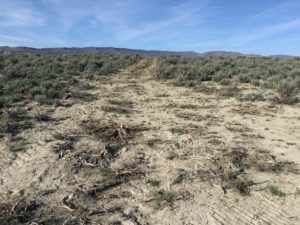
Crushed sagebrush in a “temporary” road established for drilling test holes at McDermitt Creek site. Photo: Anne White
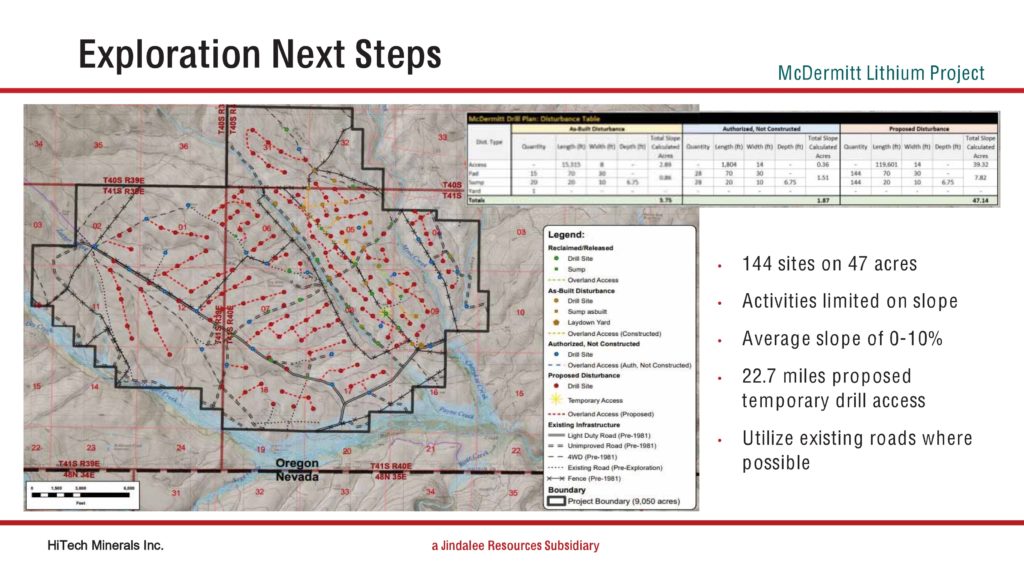
While mining has yet to begin or even be proposed, we are already witnessing the impacts of the ongoing exploratory work, with plans for 144 drilling sites across 47 acres requiring more than 22 miles of “temporary” road access criss-crossing the landscape. While the promise has been that there will be “no indication we’ve ever been there” these fragile sagebrush ecosystems take decades to recover from roads and routes that crush sagebrush and wildflowers and compact soils, making way for invasive species that can permanently alter this landscape.
Beyond these conservation concerns, we also know that large mining operations require extensive supporting infrastructure, constant use of noisy, polluting heavy machinery and even blasting to remove material, and a workforce often hired from outside the area. Stories from other communities illustrate how the presence of large industrial operations bring demographic changes that can lead to new problems with crime, violence and other social ills. While these concerns stretch beyond ONDA’s area of expertise, they are certain to be topics of concern in the local community and beyond.
So, while we cannot yet know what will be proposed at McDermitt Creek or what the impacts may be, we cannot help but ask ourselves: Will it be any different than all these other mines?
Sign up for ONDA’s free e-newsletter to stay aware of public lands issues, hear about ONDA events and build your knowledge of Oregon’s high desert landscapes and wildlife.
Speak up for Oregon’s high desert. Oregon’s high desert public lands, waters, wildlife and communities are irreplaceable. With threats to conservation escalating, the time to act is now. Your advocacy […]