Murderers Creek Riparian Monitoring
fact
Bitteroot
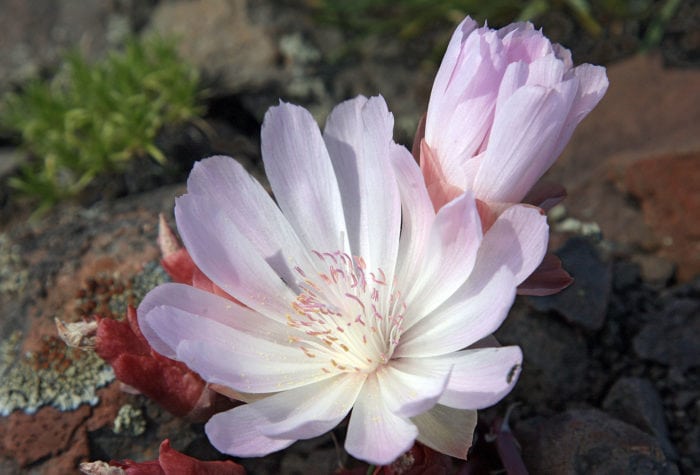
Bitteroot
Bitteroot blooms on north-facing cliffs in western North America.
The Paiute name for bitteroot is kangedya. Traditional Native American uses of the plant included eating the roots, mixed with berries and meat, and using the roots to treat sore throats.
fact
Badger
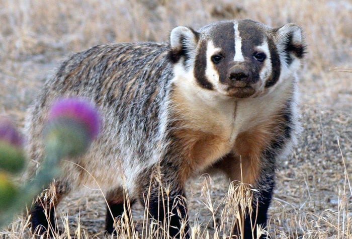
Badger
Badgers are generally nocturnal, but, in remote areas with no human encroachment, they are routinely observed foraging during the day. They prefer open areas with grasslands, which can include parklands, farms, and treeless areas with crumbly soil and a supply of rodent prey.
Badgers are born blind, furred, and helpless. Their eyes open at four to six weeks.
Latin name: Taxidea taxus
voices
Elisa Cheng, member since 2013

Elisa Cheng, member since 2013
“ONDA stewardship trips inspire me. I get to learn new things and see new places, and in the process perform important work that improves the wildlife habitat.”
Organizer: Stewardship Team
Project Timeline: 4/15/2023 through 10/31/2023
Region: Malheur National Forest
Difficulty Rating: Level 2: Moderate
Volunteers Needed: 4 volunteers
About the place
This project takes place on the traditional lands of the Burns Paiute Tribe and the Confederated Tribes of the Umatilla Indian Reservation (which consists of the Umatilla, Cayuse, and Walla Walla). This region was and remains an important fishing, hunting, and gathering area for the tribe. After being forced to leave their lands following the Bannock War, members of the Burns Paiute tribe returned and reestablished their community in the Harney Valley. The area is also part of the traditionally used lands for the Cayuse, who seasonally came to the area for fishing, hunting and gathering.
Murderers Creek is a tributary of the John Day River and is an important spawning ground for steelhead; the riparian areas provide excellent habitat for many birds.
About the project
Murderers Creek is in the upper John Day watershed on the west side of the forest. The focus of this project is to evaluate whether and how Forest Service-permitted livestock grazing is affecting stream and riparian habitat for native steelhead.
This is a photo monitoring project
This project will involve taking new photos and visiting previous photo point locations to take current photos of the riparian conditions along identified stretches of Murderers Creek and tributaries.
Timing
This project has about a seven-month window (approximately April – October), and sections of the creek will need to be monitored in the spring and again in the fall.
Difficulty
This trip will require hiking and access is mostly roadside.
Registration
An ONDA registration application and medical form are required for this project.
Project Details
All the information you will need to know about this independent project will be emailed to you after your registration is complete. Each project page has extensive information about access, technology, tools, maps and more. Please be prepared to spend 1-2 hours reviewing this information prior to heading out on your project, the good news is that time spent reviewing and preparing for your trip all counts towards your volunteer hours.