Author: Claire Cekander | Published: January 29, 2024 | Category: How-To
This article originally appeared in The Bend Bulletin on January 26, 2024.
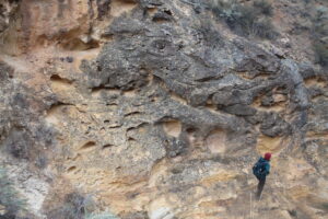
The West’s largest expanse of unprotected wildlands is rich in natural wonders, but a visit requires planning
We were miles down a dirt road deep in the Owyhee Canyonlands and had already gotten lost twice when my friend and I saw another truck heading toward us. Both vehicles slowed to a stop, and as we rolled down our windows, we saw four stunned faces that almost certainly mirrored our shock.
“What are you all doing out here?!” we asked in unison.
We were far from a known point of interest and even farther from a paved road, town or cell service. Encountering a single vehicle was a novelty. After a friendly exchange of itineraries and directions, we continued on our way, bouncing through rolling sagebrush hills and admiring the jagged rock spires that surrounded us. We saw no one else that day.
This was my first adventure into southeastern Oregon’s Owyhee Canyonlands, and I quickly learned that solitude is a hallmark of time spent in this vast landscape.
Narrowing down where to go
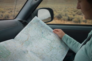
Visiting the remote Owyhee requires preparation. With so much to see and do, I initially struggled to nail down an itinerary for a multi-day trip departing from Bend. I knew that the iconic Owyhee is the largest expanse of unprotected wildlands in the American West and is rife with natural wonders, cultural significance and recreational opportunities. But where to start?
After gathering recommendations from Oregon Natural Desert Association members reflecting fondly on their trips, I had a few key destinations in mind including Painted Canyon, Leslie Gulch, Three Forks, Anderson Crossing and Jordan Craters. With no context for how to get to these places or what to do there, my first step was to narrow down the list. I read more about this region and connected with my colleagues who are hosting an upcoming online event about visiting and protecting the Owyhee Canyonlands.
One part of planning a trip to the Owyhee that was immediately clear was to steer clear of muddy roads. It seemed everyone I talked to had a survivalist story of being stuck for hours or even days in the Owyhee’s thick mud. A quick check of the weather forecast showed rain, so attempting a trip south of Jordan Valley/Highway 95 (also known as the Upper Owyhee region since the river flows north) was ill advised. This ruled out the hot spring at Three Forks and the steep walls of Louse Canyon at Anderson Crossing. Left with a rough plan of visiting the Lower Owyhee region, my next task was to figure out how to spend my time.
Deciding what to do
Not sure what I’d be getting into, I packed as much recreational gear as possible. I brought hiking clothes, trail running shoes, camping gear, a gravel bike, my fly rod and binoculars. I was ready to fully experience all the Owyhee had to offer. I decided to plan my trip around visiting Leslie Gulch because it had hiking trails, a chance to see wildlife including California bighorn sheep and camping close to the Owyhee River. And, importantly, the road through the area was gravel so I wouldn’t get stuck. Plus, I wanted to experience the “hoodoos” and natural cathedral of sheer cliffs that dominate the landscape. Driving to Leslie Gulch meant I’d also be near Painted Canyon and pass by Pillars of Rome and Jordan Craters. Now, I had a three-day plan for my time experiencing the wonders of the Owyhee.
The resulting trip
Friday night: Depart Bend after work and drive to Crystal Crane Hot Spring. If you’re going to break up the drive, you might as well sleep where you can indulge in a soak.
Saturday: Drive to the town of Jordan Valley with a stop to check out the Pillars of Rome. Continue on to the Painted Canyon and enjoy an afternoon hike among a kaleidoscope of colored rocks. Drive to Leslie Gulch to camp, get lost a few times and enjoy the expansive views along the way.
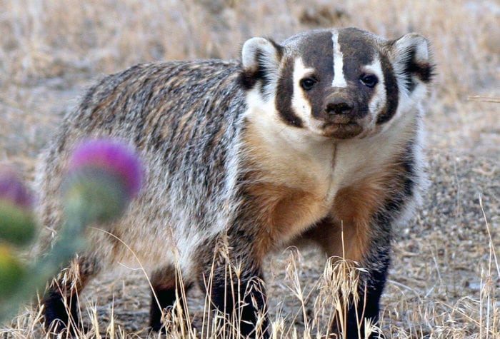
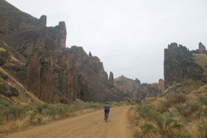
Sunday: Spend the day exploring Leslie Gulch. Bike Leslie Gulch Road, stopping at any of the numerous trailheads along the way to hike as you please. Scramble your way up the Juniper Gulch trail for a unique view or hike the Upper Leslie Gulch trail for countless opportunities to see wildlife. End the day stargazing around a campfire.
Monday: Wake up early, pack up camp, and head north to the best fishing spot below the Owyhee dam. On your way back south, treat yourself to a coffee at Skinner’s Rockhouse Coffee in Jordan Valley and head to Jordan Craters. Drive through cattle ranches, get stuck in the mud, and instead bike along the volcanic banks of Jordan Creek. Promise yourself you’ll come back soon and drive back to Bend.
It may not be the perfect itinerary, but our trip gave me a great taste of the Owyhee. I’m already looking forward to returning, and I have even been inspired to join a group of advocates supporting permanent protection for this iconic landscape.
Winter is a great time to plan a spring trip to the Owyhee. While it may take a bit of extra time and effort to organize, Oregon’s Owyhee Canyonlands will not disappoint. It’s a vast and spectacular part of Oregon that requires you to give in to the inevitably of getting lost. Or ignore your itinerary and simply enjoy the natural beauty of wherever you may end up.
—Claire Cekander is the Donor Relations Manager at Oregon Natural Desert Association, a nonprofit organization that protects and restores Oregon’s high desert public lands and waters.