Steens Mountain Wilderness Recreation Monitoring
Sage Brown Website
voices
Aaron Tani, Sage Society Member
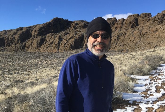
Aaron Tani, Sage Society Member
“It feels good to support ONDA on a monthly basis, because I know they never stop supporting our public lands. ONDA works to help make our lands a better place for the future, and I feel like I’m a part of that every month with my support.”
success
Oregon’s first desert wilderness
Oregon’s first desert wilderness
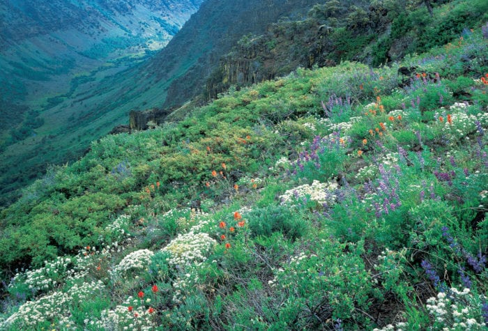
Steens Mountain: Oregon’s first desert wilderness
On October 30, 2000, Congress passed the Steens Mountain Cooperative Management and Protection Act, finishing the work that had taken ONDA and the other members of the Steens-Alvord Coalition decades
Steens Mountain is a land of startling contrasts: dramatic u-shaped
Read Morelisten
Wind and Birds in Quaking Aspen
Wind and Birds in Quaking Aspen
Organizer: Stewardship Team
Project Timeline: 6/01/2023 through 10/31/2023
Region: Steens Mountain Region
Difficulty Rating: Level 2-4: Moderate – Strenuous (depending on which portion of the project you sign up for)
Volunteers Needed: No limit
About the place
Steens Mountain is within the traditional homelands of the Northern Paiute people and the Burns Paiute Tribe. The tribe has a small reservation in Harney County, located near Burns; the Burns Paiute People are the descendants of the Northern Paiute, or Wadatika people. After being forced to leave their lands following the Bannock War, members of the Burns Paiute tribe returned and reestablished their community in the Harney Valley. The Wadatika’s homeland encompasses a territory from the Cascades east past what is now Boise, and from the Columbia south well into Nevada. Learn more about The Burns Paiute Tribe here.
Often mistaken for a chain of mountains, Steens is actually one contiguous monolith that dominates the horizon. Stretching some 30 miles wide and a mile vertical, Steens is the largest fault block mountain in Oregon, if not North America. From the high points along its long ridgeline, one can look out over the Alvord Desert to the south and gaze into deep gorges to the north.
About the project
Several trails in the Steens Mountain Wilderness lie along part of ONDA’s 750-mile Oregon Desert Trail. Over the years volunteer trips have been held to address some of the deferred maintenance on these trail systems, and more work remains!
This project is an “adopt a trail” type of design, and will offer the opportunity for you to choose a section of trail (somewhere around a mile) to hike, note any maintenance issues, and perform some light stewardship in the way of brushing the trail corridor with loppers and/or hand saws.
This is a recreation impact monitoring and maintenance project
- First, go for a hike! Walk your section of trail and enjoy the beautiful day.
- As you notice impacts, use a recreation monitoring app on your smart phone to identify and record your observations.
- Maintain your section of trail. Using a variety of trail tools (ONDA can provide access to these tools) work on your section of chosen trail as directed in the information you will receive once you have signed up for the project.
New in 2023
The Burns Bureau of Land Management has identified several trails that need more hikers…that’s right. A portion of this project will include hiking. That’s it! Hike and help establish newer trails by getting more footprints on the trail tread.
Timing
This project has about a six-month window (once the snow melts and until the snow falls again – approximately June – October), and during this time you will be asked to find a day (or days…) to conduct the work… it’s all up to you!
Difficulty
This trip will require hiking, and depending on the section of trail you choose, your hike could be almost 10-miles one way, although many sections are more accessible. This project would be ideal for backpackers who want to spend some time hiking in the Steens Mountain Wilderness. Elevations are often above 6,000′, so please take that into account.
Registration
An ONDA registration application and medical form are required for this project.
Project Details
All the information you will need to know about this independent project will be emailed to you after your registration is complete. Each project page has extensive information about access, technology, tools, maps and more. Please be prepared to spend 1-2 hours reviewing this information prior to heading out on your project, the good news is that time spent reviewing and preparing for your trip all counts towards your volunteer hours.