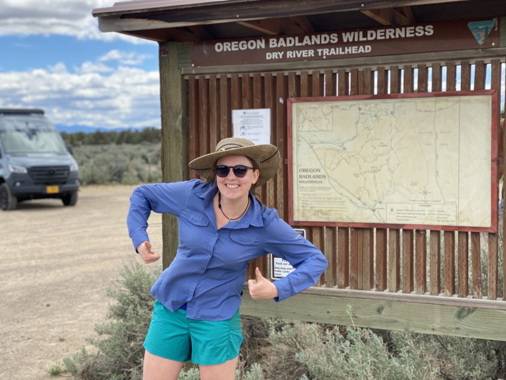
Carly “Quill” Swisher started a thru-hike of the Oregon Desert Trail in the late spring of 2020, but had to get off in McDermitt, Nevada. Undeterred, she went back June 21, 2021 and finished the complete route at Lake Owyhee State Park eight days later. The story below recounts these days on the trail, the decisions she faced and how her appreciation for Oregon’s high desert public changed.
Return to the Oregon Desert Trail
voices
John Cunningham, ONDA member and volunteer
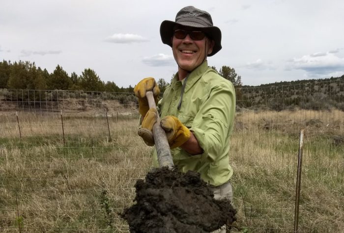
John Cunningham, ONDA member and volunteer
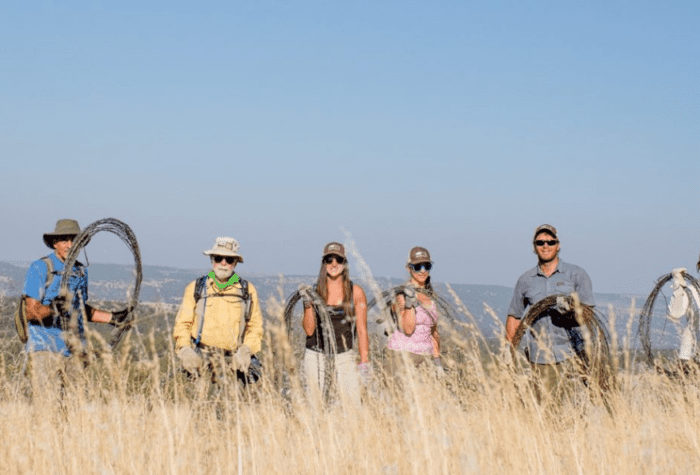
Restoration is hard slow work. It takes hold, or it doesn’t, in fits and starts. The immensity of the need can be discouraging, but we must carry on. I am so thankful ONDA carries on.
fact
Connecting Trails
Connecting Trails
The Oregon Desert Trail ties into two National Recreation Trails: the Fremont National Recreation Trail and Desert Trail.
listen
Great Basin Spadefoot Toads – a sleepy chorus
Great Basin Spadefoot Toads – a sleepy chorus
McDermitt Alternate to West Little Owyhee
After a night of car camping on the Alvord Desert playa, my friends drop me off on a dirt road near McDermitt, Nevada to experience the desert in the most immersive way possible: alone and one bad call away from heat stroke.
As they drive off to three weeks of backpacking in the Tetons, I begin my walk in what can only be referred to as a biblical plague. The Mormon cricket hatch was not one of the challenges I’d prepared for. As I walk further from town, their numbers swell. My attempt to avoid the jumping bugs – each about the size of a matchbox car- is fruitless. I try to ignore the distinct crunch of each misplaced step. There are millions of them.
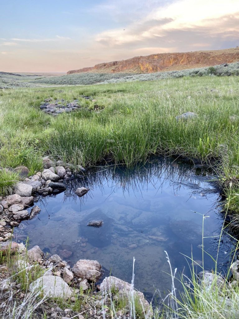
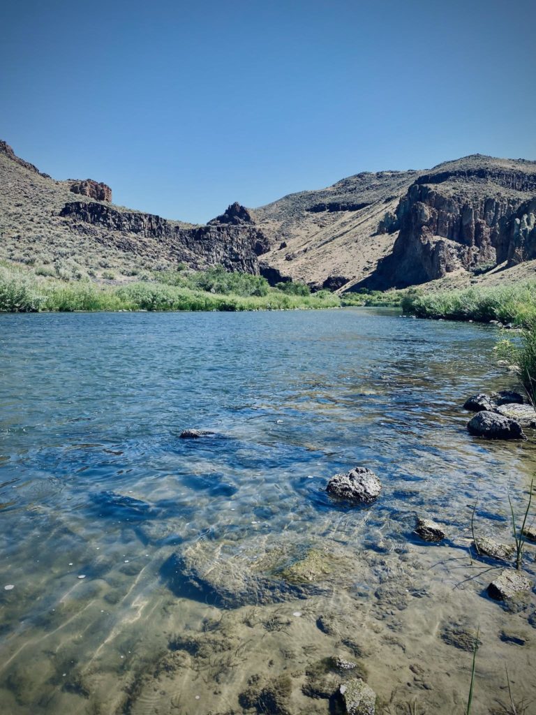
Leaving the dry basin of McDermitt, the hills once again erupt out of nowhere and remind me why I love this part of Oregon. I was last here a year ago on my first thru attempt of the ODT. I got off trail for personal reasons, but knew I would be back to experience this landscape. Despite the heat, lupine and small desert wildflowers are still in bloom and the green hills make for pleasant walking. Aside from the crickets, I see pronghorn, eagles, and fence lizards basking in the sun. Clear pools of water from the West Little Owyhee and a grassy canyon meadow make for lovely camping as I make an early night of it and enjoy the sunset from my home for the night.
West Little Owyhee to Anderson Crossing
With a heatwave looming, I plan to make the first few days high mileage to give myself a buffer for when the triple digits come.
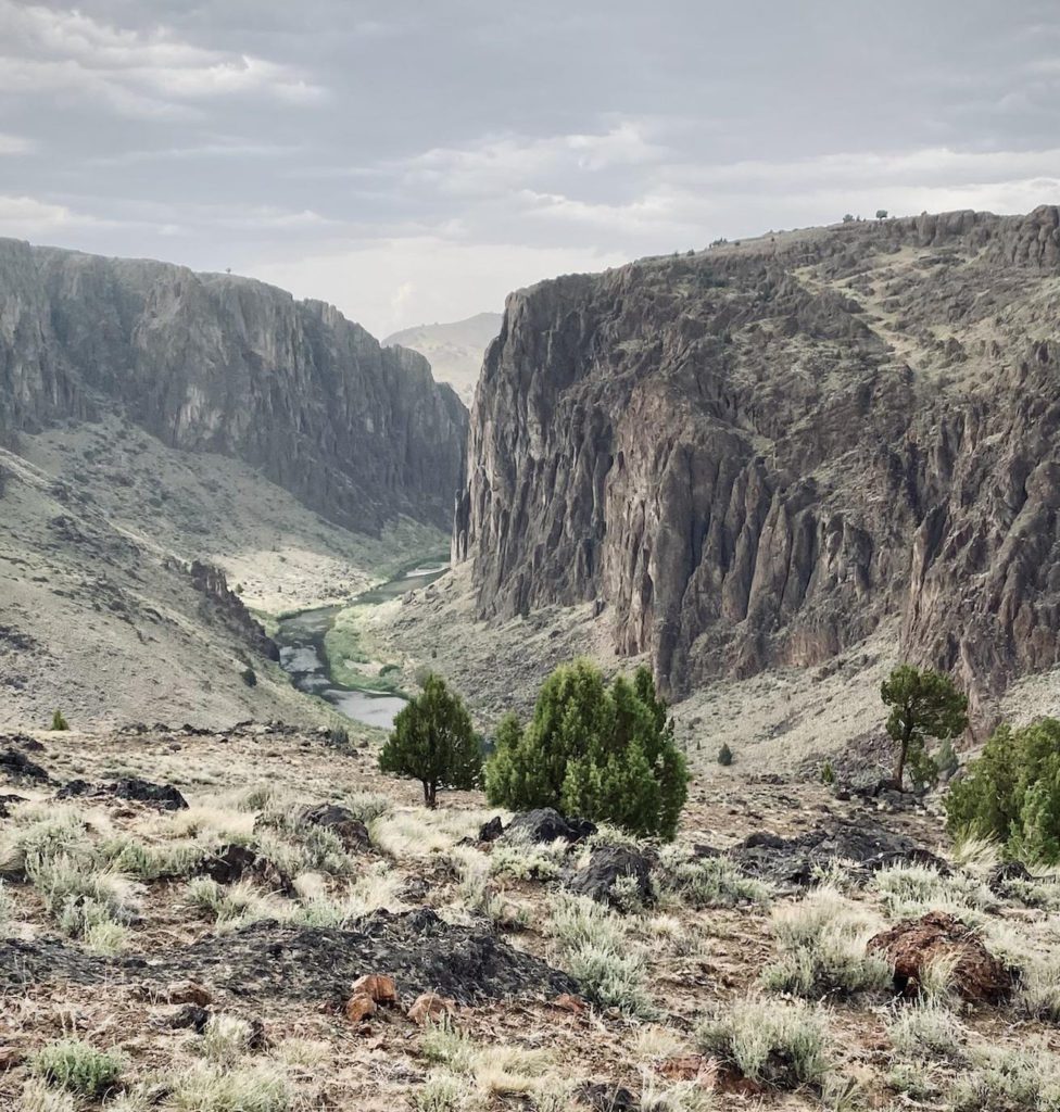
Cross-country through the stunning Louse Canyon spattered with caves and arches. Stubborn snow sticking to some spots along the valley which eventually leads to an ancient road that is best navigated with a compass.
Today, I need to make a decision on my route. Do I take the West Little Owyhee Canyon (the most difficult part of the ODT) or the high water alternate which takes roads along the rim? Between the intense heat and being solo, I take the alternate to be safe. I plan to come back and do this canyon as it looks spectacular, but considering my canyoneering experience is limited solely to my time on the ODT, it can wait for next time.
The high water alternate is a typical ODT road walk through sage. Interrupted by beautiful thunderstorms that light up the sky, hail, and crickets. Main Owyhee river crossing tomorrow.
Anderson Crossing to Three Forks
As I descend into Five Bar from primitive roads I get a taste of what this section can be. A giant fin of gray rock slices the sky, red spires and walls shoot up around me as I make my way down and through the creek, battling willows and brush. I hardly notice as I am in awe of the canyon I have suddenly found myself in.
At the crossing of the main Owyhee the drought plaguing the west coast plays in my favor and I cross easily (about to my waist). Redband trout swim around me.
From the crossing, there is an 1800s military road - originally going from Winnemucca to Rome - that winds its way steeply up and out of the canyon and then back down again into Three Forks campground. I’ll be back here with my truck and paddleboard to enjoy more of the area. For now though, it's set-up, eat food, wash up, and go to sleep.
Three Forks to Rome
Up and early to Rome. There is cell service and I take this time to catch up with friends and family as I walk the final miles of the section. The cross-county descent into ‘town’ is fairly steep, but it’s easy enough to pick my way down, across the Owyhee, and to Rome station.
Time to charge up my battery bank and fuel up on Gatorade and french fries.
The original route of the ODT (now called the Rome alternate in the guidebook) goes over a historic bridge and up onto the plateau that makes up the next section to Lambert Rocks. The rerouted ODT (thanks to aggressive dogs from the private property around the bridge that borders the original route) goes up the interstate, up a canyon, down, crosses Jordan Creek, back up, and then cross county back to where the original route meets.
It’s 6 pm at this point, very hot, and I’m exhausted. The woman I befriended at Rome station agrees to drive me over the bridge later that night to avoid the dogs (who attack the car) and I am eternally grateful. If getting the ride over the bridge counts as cheating, so be it.
It is the full Strawberry Moon that night and I hike into the early morning under the soft, pink light.
Rome to Lambert Rocks
Up and early again. With the heat, every morning means packing with a headlamp and having boots on the ground at first light. The first stop of the day is the Owyhee River - heavenly. I stay here for about an hour laying in the cool water. From here, lovely old roads take me around the hills, down rocky faces, back to the Owyhee for a break, and then cross country up to the canyon rim again with some light scrambling near the top. At the road, a very hot treeless and shadeless hike in the now record breaking temps smothering the west.
Midday breaks are spent hunkering down under my umbrella. There is zero shade with long walks between questionable water sources. The day ends with a sunset and cooler temperatures, making camp in a well of the primitive road.
Lambert Rocks to Leslie Gulch
When in Rome, as they say, I spent a few hours going over my exact schedule and water stops for the next few days. The heat is no joke and there is no getting help out here, so I need to take this seriously. The heat has killed my appetite (as expected), but I can go with a calorie deficit for a while. I can’t, however, go without sodium and electrolytes. My nutrition strategy consists of a steady intake of gels and Nuun throughout the day plus a plain tortilla if I can stomach it. Forgetting to eat is not an option this trip. My new focus becomes drinking and keeping my heart-rate down. No powering up hills, no running down them. Safe and slow.
At night, when temperatures are slightly cooler, I try to catch up on calories and force myself to eat cold-soak bean burritos. This works well; I keep hydrated, keep my energy up, and feel good and strong despite the heat.
The sagebrush plain slowly turns into red-rock spires that jut up out of the brown hills. I’ve made it to the Owyhee Canyonlands. The most impressive section of the entire ODT, and surprisingly, the largest unprotected area in the lower 48. The ‘easy route’ is blocked by private property, so my route takes me instead through a canyon with cow-trails I can only imagine are created by cows channeling their inner Alex Honnold.
I distract myself from the exposure by breaking my no-rock-collecting policy for the trip (every gram dedicated to water). Jade-colored rocks litter the ground and I pick up and leave behind different pieces until I have the perfect one for my ODT rock shelf. Before I know it, the canyon is navigated and I’m at the swim portion of the ODT.
I am delighted to be at the Owyhee again. The shore is marked with giant walls of rocks and a clear stream makes the perfect place to rest after traveling the canyon. There is a game trail one could take if one preferred not to get in the water, but I’ve been talking this part up for the past six months and it’s 100 degrees and I didn’t buy and carry two whole roll-top dry bags all this way to not get in the damn water.
“Here it is. Hope I don’t die,” I say to my video journal before packing my phone up and jumping in. Honestly, not that bad. The only mistake I make is breaking my own water crossing rule: always wear your shoes. Thanks to my decision back on the shore to attempt this section in sandals, I end up slicing my foot on a rock.
At the shore the exhaustion finally hits me. I never stopped today. From the road walk to the canyon to the swim, I was so focused on the route I didn’t stop once. I sit on the shore with my sliced foot and fantasize about someone driving up and offering me a ride the rest of the way.
I’m in a bad mood now. Hungry? Of course, I’ve eaten nothing but running gels and two tortillas. Angry? Yes, I broke my shoe rule and now I’m cleaning up and bandaging my foot due to my own hubris. Tired? I’ve been hiking since 4:45 this morning, it’s now 6 pm.
Ok, easy fixes. Snack, Aleve, and an hour nap at the campground. Walking out of Leslie Gulch provides a perfect end to the day with the towering walls around me. I walk bathed by the red-glow of the sunset folding into lavender and indigos as the night falls.
Leslie Gulch to Owyhee Reservoir
The alarm seems to get earlier every morning. I filter water and then hike up Juniper Gulch. I will go ahead and spoil that this next section ends up being my favorite so that I don’t have to find words to explain the beauty that makes up each rock. Just know that each turn is better than the last and I can’t believe I am here.
About an hour in, I see signs of heat exhaustion – probably from my intense day yesterday. I feel dizzy and stop to lay down with my feet up. I take running gels, drink more water, and try not to feel guilty about ‘wasting’ the cool morning hours. After about two hours, I feel back to normal and continue on my way.
The main concern with the last section is water. I am going through a liter a mile right now with the heat and the water is not plentiful or all that great. The pools I find in drainages are still yellow after filtering and have a distinct bitter taste that not even double treating with both a filter and aqua-mira gets rid of. That’s okay though because I am thoroughly enjoying the day. Painted Canyon is my highlight. Golden eagles nest on top of spires. Huecos speckle the walls where swallows make their homes. I even find (and leave) an arrowhead.
But of course, this is the ODT. It can’t be that easy. The canyon turns into a smaller canyon and eventually leads to boulder scrambling to get up and out. From here, there is a spring. I don’t need water because I am waiting for the supposedly better water source in a few miles, but I figure I will be a good ODT hiker and check it out so I can update the data book.
What looks like dried, caked mud surrounding the spring turns out to be a cow poop sink hole. So, at 9:30 at night, I am stuck up to my knees in black cow shit. Awesome.
I camp up on a ridge. Tomorrow, Owyhee.
Owyhee Reservoir – Last Day
4am wake up. It’s going to be a hot one and I have eight miles to the terminus.
I can’t think of a better way to end such a spectacular trip and a trail that has grown to be so important to me than the view of the Owyhee reservoir. My parents meet me at Indian Creek Campground and we walk out to the terminus on the peninsula together.
Despite growing up in the high desert, the ODT deepened my appreciation and understanding of the fragile desert ecosystem that exists in much of the state. The route differed from my other thru-hikes in how personal it always felt. The story of the Oregon desert is visible in each step and I am so thankful to those working to preserve the wild that still exists.
About the Author
Carly Swisher’s love of the high desert grew out of being born and raised in Bend, Oregon. She now spends her summers thru-hiking and the rest of the year as a high school English teacher (and want-to-be ski bum) in the beautiful Bitterroot mountains of western Montana.