The resources you’ll find here can be used in combination to help you navigate the Oregon Desert Trail route and to safely travel through the high desert.
Conditions on the ground in Oregon’s high desert can change rapidly and recreational facilities can become partially or fully closed due to any number of circumstances, including snowfall, wildfire — or a pandemic, as 2020 brought to light.
It’s always best practice to check land management agency websites for current conditions before you head out on a desert adventure.
watch
Sage Steppes
Sage Steppes
voices
Ryan “Dirtmonger” Sylva, ODT thru-hiker 2017
Ryan “Dirtmonger” Sylva, ODT thru-hiker 2017
“To me, it’s a thru-hike in an isolated place that promotes a conversation in land management, ethics and usage. Hiking across a vast and remote landscape and having a random and chance encounter with cowboys and hunters to discuss how ‘all of us’ should treat the land, how we all have a responsibility, no matter our political leanings, really showed me the pulse of the people in rural areas, especially here out west.”
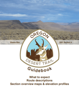
This free guidebook provides a comprehensive introduction to the ODT and all the “know before you go” information that is helpful in preparing for a hike along the route, with detailed section-by-section information, overview maps and elevation profiles.
This guidebook also includes a public lands glossary and guide to land designations along the ODT.
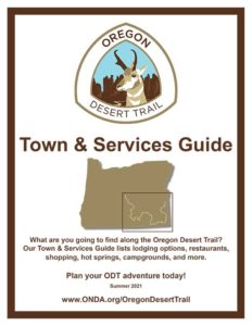
ONDA’s Town and Services Guide includes lodging options, restaurants, shopping, hot springs, campgrounds and more including a resupply strategy. This free resource, available via a PDF download, is an indispensable resource for planning your ODT adventure.
Visit Bend Directory
The western terminus of the Oregon Desert Trail is located in Central Oregon, a popular tourist region with many amenities. Visit Bend maintains a comprehensive directory of all your lodging options in Bend, from camping, to hotels and motels, and vacation rentals and AirBnBs.
A revision of the ODT resources is in the works for release later in 2024, but there are a few updates folks heading out this year will want to be aware of:
Horse Ridge Reroute
A golden eagle’s nest has been found very close to the ODT in Section 1 (waypoint CV014) and to avoid any potential disturbance to breeding eagles and nestlings we suggest two alternate routes around the nest.
Spring hikers have reported difficulty crossing a snow-melted Little Blitzen River. To avoid that hazard, hike to the historic Riddle Ranch where a bridge spans the waterway and you may enjoy a side trip to the historic ranch. Walter, Frederick, and Benjamin Riddle were three bachelor brothers who secured home sites and raised livestock in and around the ranch. Migrating from western Oregon, they settled here in the early 1900s and built their ranch by gaining control of water in the area. Since 1986 the BLM has managed the ranch for its historic values.
The map also shows a slight reroute of the original ODT to follow the existing alignment of the Fred Riddle Trail and Little Blitzen Trail.
The ODT as originally mapped followed the yellow line in the map below, but due to a very aggressive dog that struck fear in the hearts of several hikers, we suggested a reroute to the east of Rome as an alternative. Because the aggressive dog is gone now, and the Jordan Creek crossing can be quite difficult in high water, we are once again suggesting hikers take the road-walk out of Rome to cross the river on a bridge.
Trail maps include waypoints, distances between waypoints, trail surface type, water information, declination, private land boundaries, information on public land, and a selection of alternates including: Christmas Valley, Orejana Canyon, Blitzen River, Alvord Hot Springs, McDermitt, and many more options in the Owyhee Canyonlands.
OREGON DESERT TRAIL GPS WAYPOINTS
Upload the ODT waypoints to your GPS or phone, but don’t forget the paper maps…technology can fail! The .gpx file you will get after filling out the above form has the waypoints for the entire trail and all the alternates. Find detailed information on the alternate options in the guidebook and on the maps.
*Note: If you find ODT data on any hiking apps or programs, it has not be approved or verified. Please proceed with caution…it might not be accurate.
OREGON DESERT TRAIL GPS TRACKS
These .kml tracks can be uploaded to Google Earth so you can peruse the route while at home, or uploaded to your GPS device or smartphone for guidance on the trail. To minimize impacts, especially on cross-country sections, please disperse your travel, the track is a suggestion of travel.
Along with the standard suggested ODT route, the current map and guidebook also include a number of side trips and alternate versions of the ODT, including:
-Christmas Valley
-Orejana Canyon
-Blitzen River
-Alvord Hot Springs
-McDermitt
-Flag Crossing – this alternate is an extended overland option from Anderson Crossing to Five Bar, bypassing the hardest and most incredible part of the ODT through the West Little Owyhee.
-Indian Creek
-Soldier Creek
-Greeley Bar
-Leslie Gulch – a high-water alternate
WATER WAYPOINTS
This file found in the GPS data folder (ODT Water Sources.kml) has all the water sources as waypoints. These are the sources listed in the databook and guidebook and on the maps. As always, if something is inaccurate in the location of a waypoint, please let us know.
MULTI-SPORT ROUTES: These are alternates to the hiking route for many sections of the ODT. Please reference the section info in the guidebook for more details on these options. NOTE: There is no water data yet for these alternates. If you travel these sections, please waypoint any sources you find and share with us: odt@onda.org
The data book/water chart is a Google Doc, and may be one of the most important resources for hiking the Oregon Desert Trail. Where is the water? How reliable is it? Find out on the water chart and contribute your findings for others while on the trail. The information is organized by map number and waypoint. You can download the data book/water chart as a PDF or Excel file in the upper left corner of the page. Detailed directions are provided for guidance on how to use and update the water chart while on the trail.
WATER WAYPOINTS
This file found in the GPS data folder (ODT Water Sources.kml) has all the water sources as waypoints. These are the sources listed in the databook and guidebook and on the maps. As always, if something in inaccurate in the location of a waypoint, please let us know.
WATER CACHE GUIDELINES & MAPS
Most hikers will want to cache water on the first 160 miles of the route. View our caching guidelines below, and email us for maps of suggested cache spots.
Water Cache Assistance
An Oregon Desert Trail supporter has offered assistance in caching water on one of the driest sections of the trail. If you will be hiking Section 6 and would like water at the start of the section, and towards the end after coming off of Diablo Rim, here is your chance to save a day of driving on some rocky and challenging roads!
The details:
– Water will be cached for hikers who indicated they would like some water for the season (please email us to request water be placed at the cache for your hike well in advance of your hiking plans; we will communicate this to the trail supporter). Caches will be placed before each hiking season (Spring and Fall) at the start of Section 6 and bottom(ish) of Diablo Rim.
– It will be your responsibility to pack out all gallon jugs that you use.
– Our trail supporter is donating their time and purchasing the water for the caches, and suggest those using the water caches make a $10 donation to ONDA (https://onda.org/donate)
Water Cache Guidelines
When choosing the best method for caching supplies along the trail, please take the following items into consideration:
Caching on National Wildlife Refuges and National Forests is prohibited.
– Hide caches so they are not visible from roads and mark them with name and ETA date. (Sagebrush can offer good camouflage in many sections of the ODT) It is essential to HIDE your caches. Several have gone missing over the past few seasons because hikers did not hide their caches from view of roads.
– Mark cache location with a GPS waypoint to ensure you can find them.
– Avoid using flagging which can draw attention to your cache. If you deem flagging essential to recovering your cache (hiking without GPS device) please be sparing and pack out all traces to comply with Leave No Trace principles.
– Bury caches only on previously disturbed land. High desert soils and vegetation can take many years to recover from disturbances.
– When burying caches, place water/supplies in a 5-gallon bucket to prevent animal disturbances. Cover completely with dirt/rocks and GPS waypoint the location. If supplies have an odor, odor-proof barrier bags should be used inside the 5-gallon bucket.
– Please be sensitive to any archaeological or cultural resources you encounter in the desert. Preserve the past: look, but do not touch cultural or historic structures and artifacts.
– Plan to cache approximately 2 gallons [approx. 7.6 liters] per location, per person. Because individual water needs vary, please carry more water than you think you will need.
– A “heavier” plastic water jug is recommended as freezing water can crack a typical grocery store gallon jug, and extended sun exposure can make the plastic brittle.
– A high clearance 4-wheel drive vehicle is recommended to place caches. Please keep all vehicle travel to existing roads. In times of extreme fire danger, driving on primitive roads may be prohibited.
You must pack out all used containers and trash. Gallon jug containers are light and easily tied to a pack. Be even more prepared than you think you should be and have an incredible adventure.
A trail register records the comings and goings of trail users, and are typically notebooks housed in areas of high traffic for a hiker along a trail or route (post office, grocery store, hotel). They are very helpful for a number of reasons: communication between hikers, recording visitor information and use, passing on information about current hazards or trail conditions, and to aid in search and rescue efforts.
Please sign into trail registers at the following locations:
Paisley: Paisley Mercantile, ask for it at the register
Lakeview: Tall Town Bike & Camp
Plush: In-house register at Hart Mountain Store
HartMountainRefuge: In-house register at the visitors center
Frenchglen: In-house register at Frenchglen Hotel
Fields: In-house register at Fields Station
ONLINE TRAIL REGISTER
Fill out the form below and get yourself added to the online register on the bottom of this page. Why fill out the online register? If you have hiking plans along the ODT, are looking for a trail partner, or if you’re a trail angel or have other announcements and you want to get the word out, consider signing the register.
Even if your plans are only vague and tentative, we encourage you to sign the register for the purpose of building momentum within the trail community.
This page is an excerpt from our Town & Services Guide. The document lists details on all of these options; see full guide on the Town Guide tab above. Please note these mileages are based off the original ODT route, these do not include any alternate mileage.
Many businesses along the ODT will also accept resupply packages, but please call first to verify and for any special directions. Please note: Due to costs of running a business in very remote locations, some of these outposts can only resupply once a week and may not have the fresh food or selection you would like. If you do choose to send a resupply box to a business, please consider offering to donate a few dollars for the service.
If your plans change and you want to forward or have a resupply box returned, please understand if you sent to a business and not a post office, it may be difficult or require additional effort on behalf of the business to handle your box further
The Hart Mt. Refuge was established in 1936 to provide range for remnant antelope herds. It is the only spot on the trail where you need a permit, (click here for the form) but only if you plan on camping in the backcountry while on the refuge, outside the established campgrounds. Make sure to sign in the register at the headquarters!
Getting ready to go on a day-long, week-long or month-long adventure on the Oregon Desert Trail? You can learn so much by seeing how other people’s journeys have unfolded since this ambitious route made its debut in 2014. We promise you’ll pick up some solid advice and enjoy more than a few laughs from this collection of blog posts, videos and trip reports from different ODT trips.
Keep track of trail conditions in this document. Feel free to add your observations or data to the sheet.
The Oregon Natural Desert Association’s mission is to protect, restore, and defend Oregon’s desert areas, and ODT users can help us in these efforts. After you travel through these areas and spend extended time in some of these remote and extraordinary desert landscapes, please provide your feedback about the route and consider joining us as a member.
Many of our conservation goals are met by extensive wilderness inventories and science-based monitoring. Your experiences on the ground in these sensitive places can help us achieve a diverse and varied set of data that will help us defend and protect these areas. Here are a few things you can do while on the ODT that can help us in our conservation goals:
Share your observations with us
The best way we can continue to refine the route is to get your feedback about your experience along the Oregon Desert Trail. In addition, keeping track of water sources on our water chart will go a long way towards building a good picture of water conditions in the desert. Did you see something unique, exciting or strange? Take a photo and share it with us. Interesting encounters with people along the way? Let us know. In the early stages in the development of a long-distance trail many people who live along the route may be unfamiliar with long distance hiking, and that first conversation with a hiker can pave the way for future hikers’ experiences and supporters of the route. We are still discovering resources along the route to add to our Town and Services Guide, and if someone offers help or a service, let us know and we can include it for future hikers.
Take note of off-road/trail damage
Many sections along the Oregon Desert Trail route are open to multiple modes of transportation. Hikers will pass through clearly marked OHV trail systems, and on many two-track roads that are still used by vehicles and ATVs. However, if you see areas of clear habitat damage where vehicles have left the roads (especially in Wilderness Study Areas) please let us know and take photo of what you have observed. Likewise we want to promote responsible travel practices among the hikers who venture out along the route. If you see hiker or human impacts on the landscape (especially on cross country sections), please document those in photographs.
Photo monitor for impacts along the Oregon Desert Trail
Because the ODT route contains many cross country sections through tracts of intact wildlife habitat, we want to make sure our travel is not causing negative consequences on the landscape, especially in Wilderness Study Areas. We have started a photo monitoring program to collect photo data from locations along the route on an annual basis. This data will help us gauge the impacts hikers are having on the landscape. Many of the photo points can be accessed by biking and hiking. Hikers can monitor during their hikes, or on a separate trip out to the high desert. Sign up to monitor here.
Monitor Dark Night Skies
The Oregon Dark Sky Network is looking to get more sky quality measurements from the community around Lake, Harney, and Malheur counties. Anytime about 90 minutes or more after sunset is the time to take the measurement using the app Globe at Night.
Attend an ONDA stewardship volunteer trip
Every year, ONDA offers dozens of volunteer trips to some of the most scenic landscapes in Oregon’s high desert. With different projects that include removing fence, planting trees, maintaining trail, surveying potential wilderness areas and monitoring sage grouse breeding grounds, there is an ONDA trip fit for desert lovers of all abilities and ages. Best of all, most trips are free. Join ONDA today to get in on the fun.
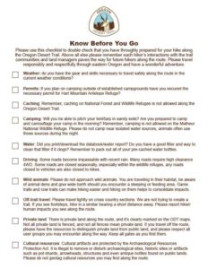
Did you check the weather? Get a permit for backcountry camping on the Hart Mountain National Antelope Refuge? Download all the materials? Use this Know Before You Go Checklist to make sure you are prepared for your Oregon Desert Trail adventure
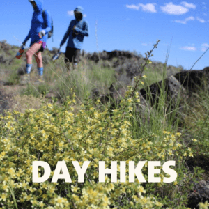
Intrigued by the Oregon Desert Trail but don’t have the time or inclination to hike all 750 miles? These day hike options provide excellent opportunities to sample short sections of the full route.
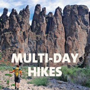
Longing for an adventure that will have you away from home for several nights?
In this post, we are offering up some ideas for multi-day trips you can take along the Oregon Desert Trail route. And, all of these trips are loops — offering that sweet joy of seeing new terrain every step of the way, all without the hassle of car shuttles or having about to worry about how you’ll return to your starting point.
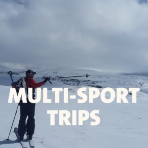
Hiking may be the most common way to approach the 750-mile Oregon Desert Trail, but there are many other ways to experience the remote beauty of the high desert along the route.
Hiking in the high desert presents unique rewards … and unique challenges! Travel safely and responsibly along the Oregon Desert Trail with these tips, principles and essentials.
The Oregon Desert Trail is an extremely challenging route for hikers, both physically and logistically. ODT travelers need to be aware of the remoteness, lack of cell communication and environmental […]
Learn more about why ONDA decided to create the Oregon Desert Trail, some interesting facts about the route, and some of the ways the ODT is engaging hikers in conservation and learning more about our public lands and eastern Oregon.
As a desert explorer, you are an integral part of the desert conservation community. Here's how you meet fellow explorers and get involved in trail stewardship and desert advocacy.

 Oregon Desert Trail Town & Services Guide