Sheepshead Mountains WSA Group Route Inventory
Jim Davis Website
voices
Aaron Tani, Sage Society Member
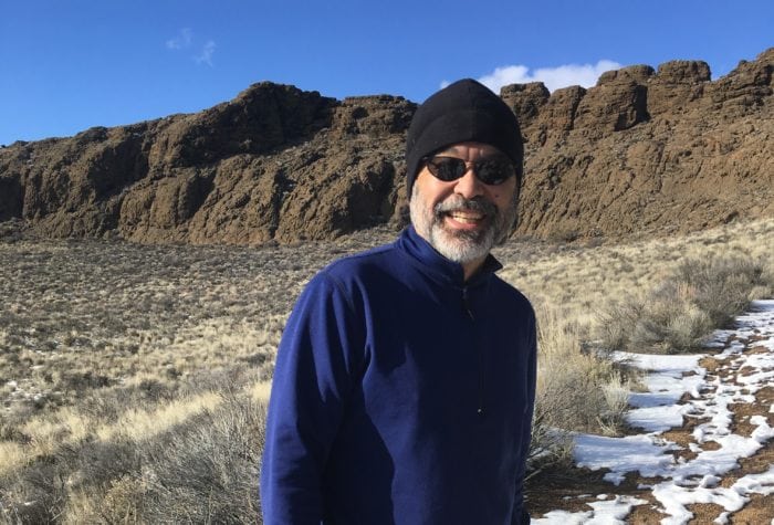
Aaron Tani, Sage Society Member
“It feels good to support ONDA on a monthly basis, because I know they never stop supporting our public lands. ONDA works to help make our lands a better place for the future, and I feel like I’m a part of that every month with my support.”
voices
Craig Terry, ONDA member and stewardship volunteer
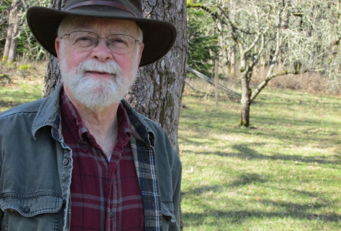
Craig Terry, ONDA member and stewardship volunteer
“The people I have had the privilege to share time with each season keep me volunteering again and again. Who else but those ONDA staff leaders would make fresh coffee at dawn each morning or pack a watermelon all day to serve as a reward under a juniper in a steep canyon?” Craig, who grew up in northwestern Nevada, says ONDA connects him with places he loves and a mission he believes in. “My grandfather and his father put up wire fences for their ranching needs. Taking out barbed wire sort of completes a circle for me.”
voices
Carl Axelsen, member since 1999
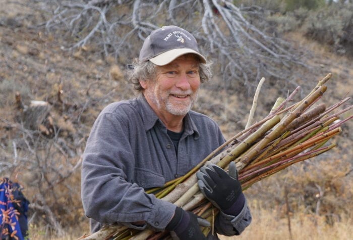
Carl Axelsen, member since 1999
You folks at ONDA really have your stuff together. Such a well-planned opportunity to comment, since figuring out how to connect with the gummint is off-putting. You make it work for me.
Organizer: Stewardship Team
Project Timeline: 9/1/2023 through 11/1/2023
Region: Steens Mountain
Difficulty Rating: Level 3: Challenging
Volunteers Needed: 2 volunteers or pairs of volunteers
About the place
Steens Mountain lies just to the west of this project area (or Tse Tse Ede or “Cold, Cold Mountain” in the Northern Paiute language) and includes an area of traditional aboriginal use by the Burns Paiute Tribe. The Tribe has a small reservation in Harney County, located near Burns; the Burns Paiute People are the descendants of the Northern Paiute, or Wadatika people. The Wadatika’s homeland encompasses a territory from the Cascades east past what is now Boise, and from the Columbia south well into Nevada. Learn more about The Burns Paiute Tribe here.
The Sheepshead Mountains Group contains a variety of topographic features. The eastern and southern portions of the area include a plateau with elevation mostly above 5,000 feet. The eastern edge of this plateau is characterized by rolling hills and broad, gentle alluvial fans which slope down to the 4,000-foot level. On the southern edge of the plateau, the descent to the lower elevations is much more abrupt and is typified by steep, south-facing ridgelines and a few deeply-cut canyons.
About the project
The Sheepshead Mountain Group contains six different Wilderness Study Areas (WSAs) separated by routes that the Bureau of Land Management recommended for closure 30 years ago, but the roads remain open. In this project, ONDA volunteers will survey the routes to see if any of them no longer qualify as roads for wilderness inventory purposes. If so, we could petition the Bureau to combine and reclassify some of the group as larger WSAs.
This is a photo monitoring project:
The 2 tasks outlined will include driving access roads and documenting them with photographs if the route is not maintained, and walking and documenting several identified routes.
Timing
We estimate 2-3 days (not including travel time) for each task and you will need to be prepared for rough driving with a high-clearance 4WD vehicle. Each task needs to be monitored this year when conditions allow. Late fall (mid-September through October) after fire season is over could be a good weather window.
Difficulty
This project is split into two tasks, each task has several shorter segments and requires about 11 miles of total hiking round trip. The hiking is along old routes which may be uneven and hard to follow.
Registration
An ONDA registration application and medical form are required for this project. You will also have the option to volunteer for other projects that become available throughout the year.
Project Details
All the information you will need to know about this independent project will be emailed to you after your registration is complete. Each project page has extensive information about access, technology, tools, maps and more. Please be prepared to spend 1-2 hours reviewing this information prior to heading out on your project, the good news is that time spent reviewing and preparing for your trip all counts towards your volunteer hours.