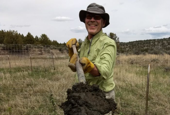
By Renee Patrick, Program Coordinator for the Oregon Desert Trail
When ONDA looked east in 2011 with the thought of establishing a desert hiking route that would connect into the important sagebrush steppe ecosystems they had been working to protect, defend, and restore since 1987, they looked to the Desert Trail.
The Oregon Desert Trail and Desert Trail? Yes, they are two separate long-distance hiking routes. The Desert Trail was conceived by Burns biology teacher Russ Pengelly in the early 1970s. Russ stood on the top of Steens Mountain five decades ago and envisioned a hiking route that stretched through the great basin and into the remote deserts of the west all the way from Mexico to Canada. Instead of building a trail, he envisioned a quarter-mile wide corridor suitable for hikers, mule packers and equestrians.
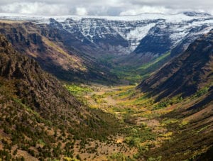
The Desert Trail set the tone for what would become the Oregon Desert Trail. It had been done before, it could be done again. The Desert Trail offered some of the only recreation “infrastructure” that existed in eastern Oregon, so it seemed natural to tie into this long-distance route for some of the mileage, especially since it traversed the ecologically diverse and iconic, breathtaking landscapes of Steens Mountain, the Alvord Desert and the Pueblo Mountains.
And the hikers love it! Since ONDA released Oregon Desert Trail maps and a guidebook to the public, 33 hardy hikers have completed all 750-miles, and hundreds more each year have spent time on a day-hike, weekend trip, or week-long backpacking adventure, often on sections of the Desert Trail.
I started attending Desert Trail Association meetings in 2016 shortly after starting my work on the Oregon Desert Trail and found a passionate group of people who loved getting on the landscape and hiking sections of the route (or other amazing spots in the desert). The group was eager for a younger engaged membership that could take on the mantle of what they had accomplished and continue their efforts to create a long-distance hiking route.
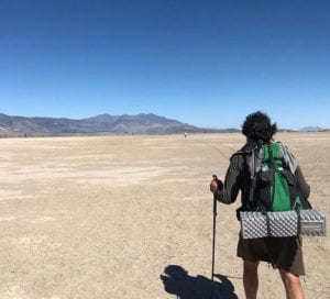
Now, after almost five years of working on the Oregon Desert Trail, I know firsthand how much work goes into establishing 750 miles, much less 2,000+ miles! It’s a tall task and one that takes an incredible amount of time, energy, and money to do.
On a cold, windy Friday in May 2020, the Desert Trail Association and Foundation officially decided to liquidate the organization after 48 years of working to establish their Mexico to Canada desert route, but I’m happy to report that ONDA will continue to tend to the Oregon sections of their route that overlap with the Oregon Desert Trail.
The Desert Trail Foundation’s folding will pass on important resources to enable ONDA to continue to hold stewardship opportunities to improve the route. I’ve led seven different trail maintenance trips in the Steens Mountain Wilderness since 2017, and worked with over 60 volunteers from around Oregon to improve the trails, and parts of the shared Desert Trail and Oregon Desert Trail corridor. And the work will continue. By funding trail work along sections of the Oregon Desert Trail, the foundation is helping to open up trails that have had no recorded trail maintenance…ever! Our volunteers have spent countless hours over the past few years cutting out 35-year-old sagebrush that had grown over the trail tread in Big Indian Gorge. Our volunteers have cleared brush that had horse packers ducking under tree limbs, and hikers emerging from the trail with bloody knees from climbing up and over downed trees (that was me). We’ve cleared almost five miles of the Big Indian Gorge Trail, and it will take us another few years to open up the whole trail, but we have a dedicated and passionate group of volunteers that jump at the chance to spend a week in an amazing glaciated gorge and improve the hiking experience for everyone.
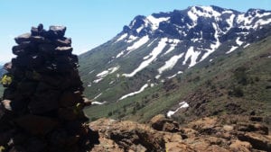
ONDA’s work to refine the shared route has resulted in some changes in the Pueblo Mountains section. Private landowners frequently found misplaced hikers wandering onto their land, so we rerouted the first three miles south from Fields to avoid this situation. Hikers reported a nightmarish situation of trying to push their way through thick vegetation in Denio Creek, sometimes hiking up high to avoid the tangle in the riparian area, only to get cliffed out and trapped by the terrain, so I investigated the next drainage to the north and found an alternative for hikers to avoid Denio Creek, hit an extra water source, and take in the sights of an old mine perched on the side of this Wilderness Study Area.
ONDA will continue to keep the user experience in mind, and improve the alignment as conditions on the ground change, private land boundaries change, and public land management changes. Thank you, Desert Trail Association and Foundation, for the support and commitment to making the Oregon section of your route a viable backpacking experience in the future!

The Oregon Desert Trail maps, guidebook, water chart, town and services guide, and more are all free, all available with the new updates for our shared route, and all online.
Please join us in our work to engage hikers and other forms of quiet recreation in discovering the beauty and importance of intact ecosystems, of advocating for a healthy network of public lands open to us to explore, to encourage all desert-lovers to become more engaged with the future of landscapes that makes routes like the Desert Trail and Oregon Desert Trail possible.
