Oregon Desert Trail Impact Monitoring
Jim Davis Website
listen
Western Meadowlark Dawn Chorus
Western Meadowlark Dawn Chorus
voices
John Cunningham, ONDA member and volunteer
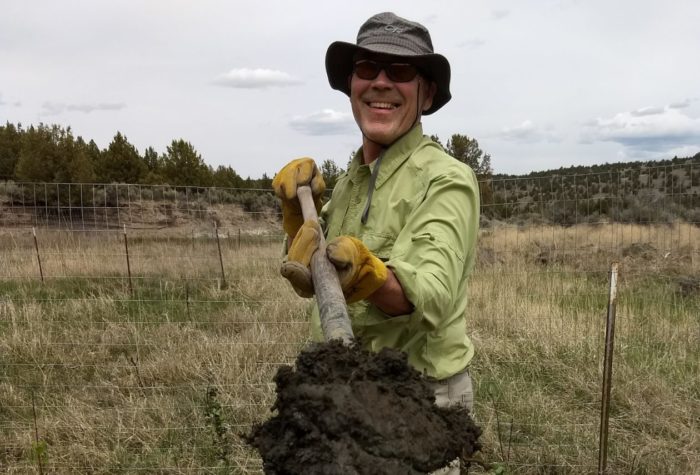
John Cunningham, ONDA member and volunteer
Restoration is hard slow work. It takes hold, or it doesn’t, in fits and starts. The immensity of the need can be discouraging, but we must carry on. I am so thankful ONDA carries on.
listen
Great Basin Spadefoot Toads – a sleepy chorus
Great Basin Spadefoot Toads – a sleepy chorus
Organizer: Stewardship Team
Project Timeline: 4/01/2024 through 11/30/2024
Region: Eastern Oregon
Difficulty Rating: Level 5: Extreme
Volunteers Needed: No limit
About the place
ONDA’s conservation work takes place on the traditional lands of the Northern Paiute, Wasco, Warm Springs, Bannock and Shoshone people, as well as ceded lands of the Confederated Tribes of the Umatilla Indian Reservation, and on lands currently managed by the Burns Paiute Tribe and the Confederated Tribes of Warm Springs. Many Indigenous peoples live in Oregon’s high desert region today, including members of the Burns Paiute Tribe, the Confederated Tribes of Warm Springs (Wasco, Warm Springs and Paiute), the Klamath Tribes (Klamath, Modoc and Yahooskin) and the Fort McDermitt Paiute and Shoshone Tribe.
An ONDA initiative since 2011, the 750-mile Oregon Desert Trail traverses some of the most spectacular natural areas of the state’s dry side, including Hart Mountain National Antelope Refuge, Steens Mountain, and the Owyhee Canyonlands.
About the project
About 35% of the 750 miles of the Oregon Desert Trail involve cross country travel in the sagebrush sea; hikers will navigate these sections with map and compass or gps devices. We direct hikers to avoid making impacts on cross country sections, and instead of following footprints, to hike in a similar bearing. The goal is to avoid creating “trail” by having people on the landscape walking in the same alignment over and over; we want intact habitats and ecosystems to be the primary importance out there…and to help hikers understand how to travel without creating impacts.
This is a photo monitoring project that will help us gauge hiker-related impacts, and help us to get in front of any issues that might occur in areas of cross country travel in “pinch points” on the landscape that might funnel hiker traffic.
There are 16 pre-determined photo points that can be monitored in 2 ways:
As you are hiking the Oregon Desert Trail: We will give you access to the photo monitoring waypoints, and as you approach a waypoint on the hike, use the materials we provide to match and take geolocated photos. You do not need to monitor all photo points; especially as you decide which alternate routes to take.
As a stand-alone project, independent of a thru-hike or section-hike of the ODT: We will give you directions on accessing each point without having to hike all of the Oregon Desert Trail.
NOTE: because most points are on cross country sections, most monitoring will involve hiking and navigating, a few points are partially accessible by bicycle or vehicle.
NOTE: you don’t have to monitor all photo points at once, or at all. Multiple volunteers will be working on this monitoring project over the year, so pick the places you want to visit according to the time you have available. Several observations at all photo points during the year is the goal.
This is a photo monitoring project
Volunteers will take geolocated photos with their smartphones or devices along predetermined photo points on the Oregon Desert Trail.
Timing:
This project will involve multiple volunteers during the year, however shoulder seasons (April-June & September-October) are the most suitable times for hiking the Oregon Desert Trail. You can hike as much of the ODT as you like or as many times as you like. We ask volunteers who sign up for this project to make at least one monitoring trip in 2024 for a minimum of four hours.
Difficulty
Volunteers will need to be comfortable with off-trail navigation and hiking long distances. Some photo monitoring points could be visited as a day trip, others will involve a multi-day backpacking trip. You can monitor one photo point, or all of them; multiple photos taken throughout the year taken by different volunteers are encouraged.
Registration
An ONDA registration application and medical form are required for this project. You will also have the option to volunteer for other projects that become available throughout the year.
Project Details
All the information you will need to know about this independent project will be emailed to you after your registration is complete. Each project page has extensive information about access, technology, tools, maps and more. Please be prepared to spend 1-2 hours reviewing this information prior to heading out on your project, the good news is that time spent reviewing and preparing for your trip all counts towards your volunteer hours.