Virtual Gallery Exhibit
Shannon Phifer Website
listen
Great Horned Owls and Western Screech Owls
Great Horned Owls and Western Screech Owls
voices
Durlin Hicock, Alice Elshoff Award winner
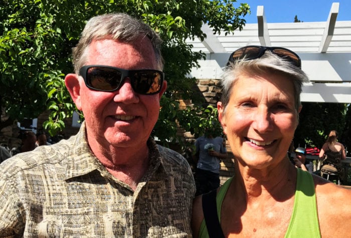
Durlin Hicock, Alice Elshoff Award winner
“Protecting public land is part of my spiritual being. It’s central to my identity to be in wilderness and to see it protected.” Durlin is proud to protect public lands for future generations, saying, “The highlight of my childhood was our family’s weekend outdoor trips. I look forward to my grandchildren having similar experiences outside in their lifetimes, and it wouldn’t be possible without ONDA.”
watch
Oregon Desert Trail Map
Oregon Desert Trail Map
Join, Renew, or Give a Gift
When you donate to Oregon Natural Desert Association, you become part of a community of individuals who share your passion for conserving the lands, waterways and wildlife in the high […]
Read MorePurchase Your Wild Desert Calendar
ONDA’s Wild Desert Calendar showcases the breathtaking beauty of Oregon’s high desert through a collection of stunning images generously donated by talented photographers. In addition to captivating landscapes, the calendar […]
Read More