Lake Abert’s delicate ecosystem depends on consistent and reliable fresh water inputs to maintain optimal salinity to support a complex food web that feeds the abundant birdlife at the lake. Unfortunately, water withdrawals, reservoir construction and drought have reduced water flow into the lake, increasing its salinity, destabilizing the food web and even drying up the lake in some years.
Read on below to find out more about the various threats to Lake Abert.
listen
Wind and Birds in Quaking Aspen
Wind and Birds in Quaking Aspen
voices
Durlin Hicock, Alice Elshoff Award winner
Durlin Hicock, Alice Elshoff Award winner
“Protecting public land is part of my spiritual being. It’s central to my identity to be in wilderness and to see it protected.” Durlin is proud to protect public lands for future generations, saying, “The highlight of my childhood was our family’s weekend outdoor trips. I look forward to my grandchildren having similar experiences outside in their lifetimes, and it wouldn’t be possible without ONDA.”
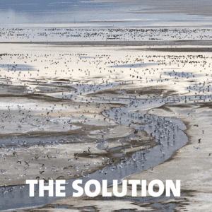
Brine shrimp and alkali flies provide invaluable food sources to more than 80 species of waterbirds who stop at Lake Abert along their international migrations between destinations as far away as Alaska and Argentina. Decreasing water levels resulting in extremely high salinity threaten these invertebrate populations and the hundreds of thousands of birds who depend on them as their migratory fuel.
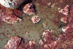
Dying brine shrimp accumulate along Lake Abert’s shore as a result of hypoxic conditions brought on by high salinities and hot weather. Photo: Ron Larson
Brine shrimp, alkali flies and microbes are specially adapted to tolerate the harsh, hypersaline conditions of Lake Abert. However, even these organisms have limits to their resiliency. The shrimp and flies thrive when salinity levels are between 3 and 8%. When salinity drops below or rises above that threshold, the species’ populations plummet due to inhospitable conditions. Higher salt concentrations and lower water levels reduce oxygen content in the lake or eliminate oxygen altogether when the lake is dry and winds are calm. Attempting to increase oxygen transport, brine shrimp produce hemoglobin which turn the shrimp bright red, and if oxygen levels drop further the shrimp ultimately succumb to these hypoxic (oxygen-depleted) conditions.
Although alkali fly larvae are able to remove excess salt from their bodies, salinity of 15% or higher requires additional energy to regulate internal salt concentrations. This high energetic cost results in reduced survival rates through all alkali fly life stages. When the lake dries out, fly larvae can only survive in the springs around the lake where salinities are reduced and brine shrimp cysts (similar to eggs) containing partially developed embryos, lose their viability over time. Both invertebrate offspring are more readily accessed in the shallow water and springs, increasing predation of both species and consequently, reducing future populations.
Additionally, the microbes the shrimp and flies feed on are also stressed by high concentrations of salt and decreased oxygen, disrupting the entire food web of the lake. With decreased competition, no predators, and increased salinity, Archaea flourish and “bloom,” turning the remaining lake water blood red.
In 2014, the lake went dry for the first time since the 1930s, shrinking to 5% of its maximum size. Salt concentrations exceeded 15%, surpassing the threshold at which brine shrimp and alkali flies can survive, to the detriment of tens of thousands of migratory birds. Low lake levels persisted for several years, finally appearing to recover in 2017. However, since 2018 the lake’s water elevation has been shrinking and in 2021, the lake dried out again and salinities reached 25%, a lethal concentration for shrimp and flies.
A myriad of factors have reduced water flow into the lake, increasing its salinity or drying up the lake altogether. Important aspects of water use in the Chewaucan Basin remain unmeasured, water rights have been over-appropriated, and a poorly regulated reservoir at the bottom of the watershed has reduced flows from the Chewaucan River — Lake Abert’s primary water source — to the lake for decades.
As a terminal lake fed primarily by the Chewaucan River, water levels and salinity in Lake Abert are dependent on a balance between fresh water flowing into the lake and evaporation. However, a myriad of factors has upset that balance so that not enough water is arriving to the lake.
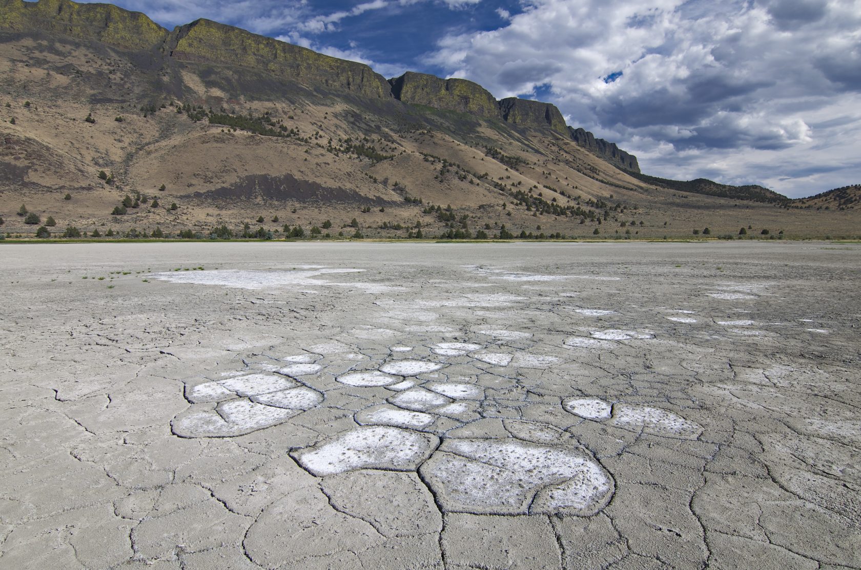
Cracked, desiccated mud flats cover the southern end of Lake Abert in July 2014, which is typically inundated with water. Photo: Ron Larson
Water management in Oregon is based on the Doctrine of Prior Appropriation. Water rights are allocated on a “first in time, first in right” basis, meaning the earlier in time an individual first secured a water right (priority date), the more senior their water right. In years where there is not enough water available for all water right holders, senior rights are fulfilled first, resulting in decreased quantities available to those with junior rights. Junior users and those without water rights — such as Lake Abert — are sometimes left with no water at all when all available water is diverted by those with senior water rights. This means the water has been “over-appropriated.”
Water rights for surface and ground water are allocated, permitted, and regulated by the Oregon Water Resources Department (OWRD). State agencies may apply for water rights for rivers and water bodies to keep water instream for fish, wildlife, recreation or other “beneficial uses.” However, senior water rights with an earlier priority date receive their full water allocation before junior instream water rights are fulfilled. Lake Abert has no water rights.
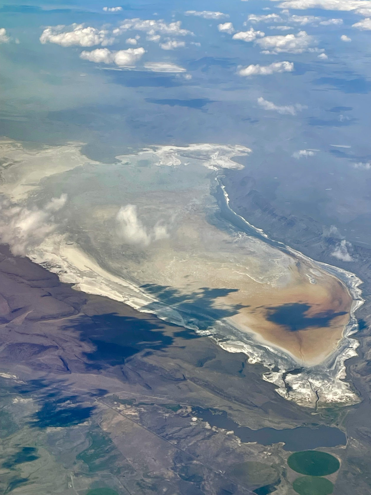
Satellite imagery shows a rapidly shrinking Lake Abert over a period of four years, from 2011 to 2014. Photo: Ron Larson
There is only one stream gage in the Chewaucan River, located near Paisley approximately 23 miles upstream from Lake Abert. OWRD does not require water use to be measured and reported, meaning there is no clear record of actual water use in the basin. A 1971 study estimated that approximately half of the water in the Chewaucan River between 1924-1964 did not make it to Lake Abert. An in-depth analysis of Lake Abert’s drying in 2014 concluded that the drying was driven by upstream water withdrawals. An in-depth analysis of Lake Abert’s drying in 2014 published by University of Montana geoscientist Johnnie Moore concluded “Without upstream withdrawals, the Lake Abert ecosystem would have been stressed in recent droughts, but not decimated as it has been in the last two years.” Demand for new out of stream uses has only grown over time even while drought and climate change has reduced overall water availability.
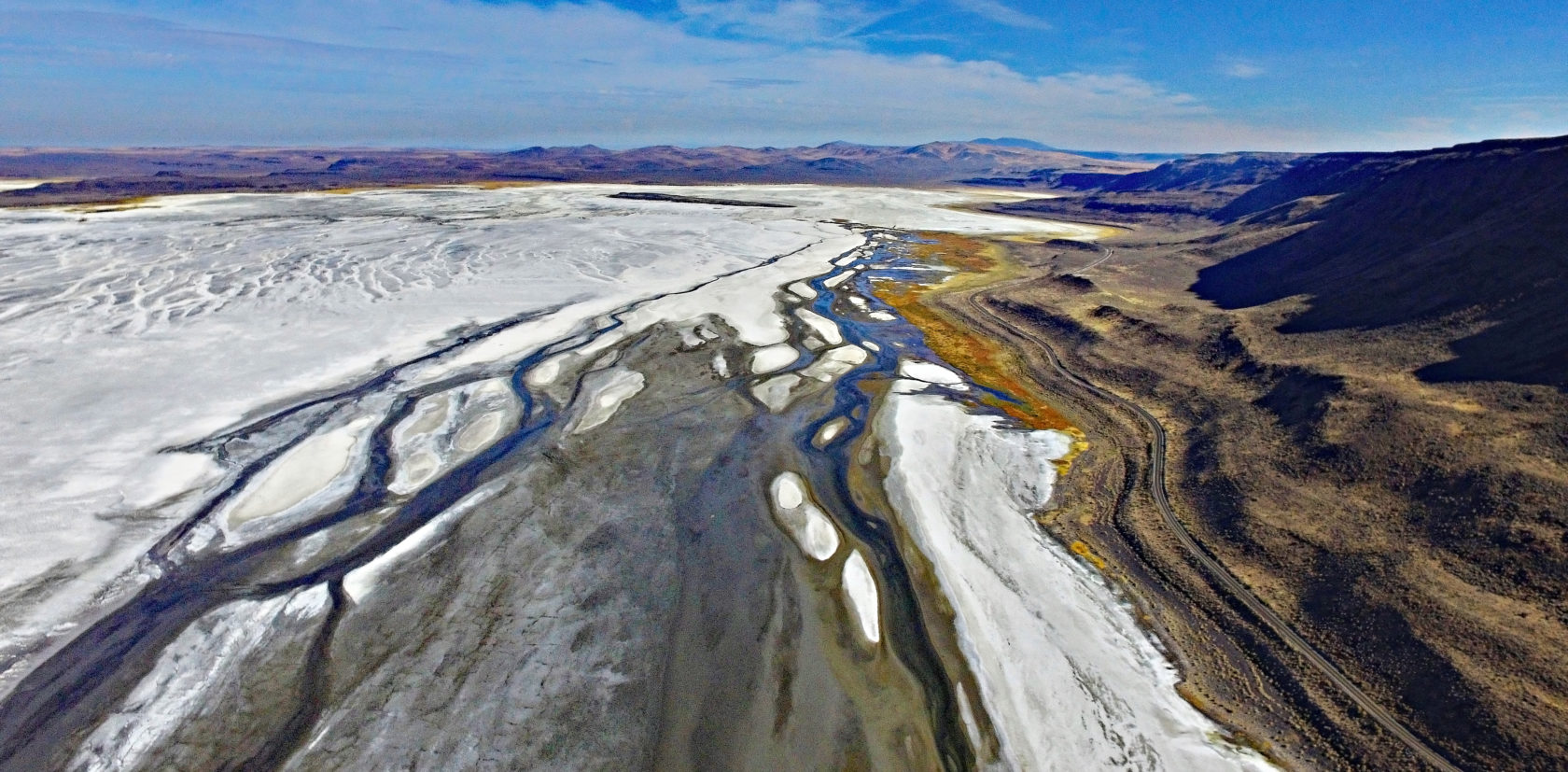
Rivers End Ranch Reservoir is full in June 2021 while a nearly dry Lake Abert is red with an archaea bloom. Photo: Ryan Houston
A reservoir constructed at bottom end of the Chewaucan River in the early 1990s limits how much water is able to reach to Lake Abert. In its initial permitting, the Oregon Department of Environmental Quality (DEQ) required the reservoir constantly release water to the lake if the lake water level dropped below an elevation of 4,252 feet. The Oregon Department of Fish and Wildlife (ODFW) also recommended operation of the reservoir be reevaluated if Lake Abert went dry or every five years, and OWRD determined a permit would only be approved with pass-through flow conditions incorporated. However, these requirements and the operating permits were abandoned along with agency oversight when construction uncovered important Native American graves and archaeological resources. Without this oversight or management, water makes it through the reservoir and to Lake Abert only when it overflows or is voluntarily released. The water right permits for this reservoir remain disputed and unresolved today, more than 30 years after construction began.
Although endorheic lakes naturally fluctuate in size due to inter-annual variations in precipitation, Lake Abert has been markedly shrinking in size since 2000. In addition to the various water management issues, drought and climate change have impacted water availability throughout the region and increasingly less water reaches Lake Abert each year.
A decades-long drought throughout the Western U.S. is impacting nearly all aspects of life in eastern Oregon. In 2021, the U.S. Drought Monitor reported drought conditions to be the most expansive and intensive drought the western United States has experienced in the past century, with south-central and southeastern Oregon recording the lowest total precipitation relative to the average of anywhere in the state. An article published in early 2022 reported the past 22 years have been the driest two decades since at least the year 800 CE. For nearly half of the past 23 years, Oregon’s Governor has declared a drought emergency in Lake County, further underscoring the severity of water shortages in the Chewaucan Rivier Watershed.
Two years after historic water shortages and near desiccation in 2014, freshwater springs along the eastern boundary provided the only available water at the north end of Lake Abert. Photo: MaxDepth Aquatics, Inc.
Drought impacts the hydrological system by reducing snowpack in the Fremont-Winema National Forest which in turn, reduces stream flow in the Chewaucan River. Effects of climate change, such as rising temperatures, exacerbate drought by shifting precipitation type from snow to rain, altering the accumulation and timing of snowmelt, decreasing and shifting water availability in streams, and increasing evaporation.
Evaporation of Lake Abert has been increasing since the 1980s. With less than 15 inches of annual precipitation falling directly on the lake and an annual evaporation rate of 40 inches, the lake operates at a deficit every year and is therefore, reliant on inflows from the Chewaucan River to maintain water levels and optimal salinity. When the lake water levels are extremely low, such as in 2014, it takes years of increased precipitation and steady inflows from the Chewaucan River for the ecosystem to rebound.
Prolonged drought may result in more frequent desiccation and a longer recovery period coupled with a longer duration of extremely high salt concentrations and low dissolved oxygen content, hindering brine shrimp and alkali fly productivity and resiliency, and thus, the hundreds of thousands of migratory birds that depend on them. Under these unstable and highly variable conditions, the ecosystem could reach its ecological tipping point or threshold, resulting in irreversible species loss.
A more recently-identified threat to Lake Abert is a pair of pumped storage hydropower facilities. Proposed by Pacific Power as an energy storage solution, this closed-loop system would withdraw water from the Chewaucan River and its tributary Crooked Creek to fill two lower reservoirs. Water would then be pumped uphill to upper reservoirs located atop Abert Rim and Winter Ridge, capturing energy as it falls downhill through pipes back to the lower reservoirs. Additional withdrawals from an already over-appropriated system to fill and maintain reservoirs for the proposed projects will compound water shortages in the basin and further threaten the future of Lake Abert.
Read on to find out what ONDA is doing to save Lake Abert or to learn more about this invaluable ecosystem.
For new articles, published science and links to additional information about Lake Abert, check out our Resources page.