21 Day Hikes
Along the Oregon Desert Trail

Author: Renee Patrick  | Updated: August 17, 2021  |  Category: Where-to

Intrigued by the Oregon Desert Trail but don’t have the time or inclination to hike all 750 miles? These day hike options provide excellent opportunities to sample short sections of the full route.

Refer to each section to in the Oregon Desert Trail materials to find everything you need to know to successfully head out on each hike (unless noted):

  • Guidebook
  • Maps
  • Databook/water chart
  • Town & Services Guide
  • GPS data

listen

Western Meadowlark Dawn Chorus

Western Meadowlark Dawn Chorus

listen

Great Basin Spadefoot Toads – a sleepy chorus

Great Basin Spadefoot Toads – a sleepy chorus

watch

Sage Steppes

Sage Steppes

Oregon Badlands Wilderness (Section 1) - 9 miles one way

This is 30,000 acres of fascinating lava flows and ancient juniper trees. You may see pictographs, as the area known today as the Badlands Wilderness is the ancestral land of the Confederated Tribes of Warm Springs and Northern Paiute. These are fragile cultural artifacts that you can admire, but not touch. You will also find some of the oldest trees in Oregon, bright displays of desert wildflowers and castle-like rock formations.

Try out the first nine miles of the Oregon Desert Trail from the Tumulus Trailhead to Flatiron Rock Trailhead; set up a shuttle to hike the full traverse, or do an out and back from either trailhead.

There are many other trails in the Oregon Badlands Wilderness and you could easily turn your trip into a loop hike.

Crack in the Ground (Christmas Valley Alternate) - 2 miles one way

Crack-in-the-Ground is an ancient volcanic fissure over 2 miles long and up to 70 feet deep. Crack-in-the-Ground exists today nearly as it did shortly after its formation thousands of years ago. An established 2 mile trail along the fissure’s bottom offers a unique hike along an Oregon Desert Trail alternate.

From Christmas Valley, head east on the Christmas Valley Highway for approximately 1 mile. Turn north (left) onto Crack-in-the-Ground Road and continue for about 7 miles, being sure to turn left onto Lava Craters Road, following signs to Crack in the Ground and a parking area with vault toilet.

Black Hills (Christmas Valley Alternate)

The rocky outcrops that define the Black Hills Area of Environmental Concern (ACEC) are all that remains of an eroded dome of volcanic tuff, formed 4-7 million years ago near today's Christmas Valley, and an Oregon Desert Trail alternate. Covered with hardy, low-growing plants, this high desert ecosystem hosts three BLM Special Status Species of plants: Cusick’s buckwheat, Warner Mountain bedstraw, and snowline cymopteris.

From Christmas Valley, Oregon, take County Road 5-14F south. When the main roads turns west, continue south on the dirt road to the sign at the north edge of the site. To enter the site, turn east (left) and travel for .25 mile, then turn south up a rough jeep trail to the visitor information sign. This road should only be used by 4-wheel drive vehicles. There are no trails in this area, so the hike will be driven by your curiosity to explore.

Diablo Rim (Section 6) - 5.5 miles one way

Diablo Rim is a large heavily faulted uplift on the east side of Summer Lake. The Rim is segmented into many narrow longitudinal sections with a number of distinctive highpoints.

Access Diablo Peak from the town of Summer Lake: Turn onto Thousand Springs Lane just north of the rest area in town. Follow this road about 6 miles to a fork in the road, and turn right (south). Drive another 1.2 miles and park before a slight rise in the road, and before reaching the Thousand Springs Ranch. Head cross country towards Cat Camp Draw, and follow that up to Diablo Peak.

Note: ODT materials don't include this approach hike. Find GPS tracks for the route here.

Fremont-Winema National Forest (Sections 7-8)

Below are six day hike options, keep in mind that many other trails in this National Forest provide other hiking options.


  • Chewaucan Crossing: From the free campsites at Chewaucan Crossing, hike south along the Fremont National Recreation Trail for a lovely out and back trip.

  • Avery Pass: Avery Pass is accessible to most vehicles. Drive through Paisley, and continue south about 6 miles to turn right onto Clover Flat Road. Turn right at a sign indicating Morgan Butte Lookout and Avery Pass (follow signs to the pass). You can walk in either direction and enjoy some time on the Fremont National Recreation Trail and ODT!

  • Morgan Butte Lookout: Morgan Butte lookout is one of a few remaining staffed fire lookout towers. Directions are the same as Avery Pass, with one different turn, marked by signs to guide you up. You can drive up and enjoy the view or hike north or south on the ODT and Fremont National Recreation Trail. There is even a pit toilet on top.

  • Moss Pass: Moss pass has a nearby horse camp, a spring, and plenty of space to camp out. Drive south out of Paisley and turn right onto Clover Flat Road. Drive 9 miles and turn right on FS 3510. Follow this up to Moss Pass. Hike north or south on the ODT and Fremont National Recreation Trail.

  • Mill Trailhead: Mill Trailhead is another entry point to the Fremont National Recreation Trail. From highway 395 about 12 miles north of Lakeview, turn left onto FS 3721, there is a trailhead sign to guide you just under 2 miles to the trailhead.

  • Vee Lake: Vee Lake is the eastern terminus of the Fremont National Recreation Trail, and offers a primitive camp site with pit toilet, picnic tables, and good views of the Warner Mountains. Hike south to hit some fantastic ridge-walking on Crook Peak (6.5 miles one way) and McDowell Peak.

  • Note: Some of these trails may be closed due to recent fire activity. Find more information here. And here.

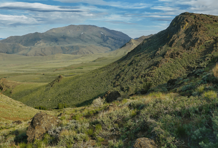
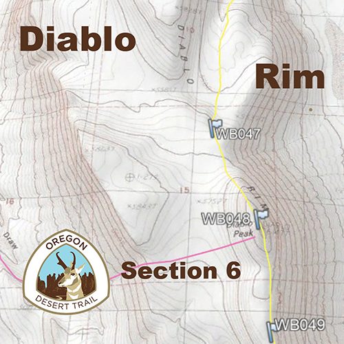
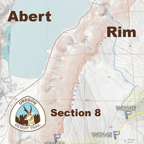
Abert Rim (Section 8) - 1.5 miles one way, 2,000' elevation gain

Abert Rim is the largest exposed fault scarp in North America and, from the top, you will have a view of Lake Abert, Oregon’s most saline lake. Keep an eye out for bighorn sheep along this hike. A herd was introduced in 1974 to help perpetuate the species. Other wildlife you might see includes prairie falcons, golden eagles, great-horned owls, red-tailed hawks, deer, antelope, cougar, bobcat, coyotes, badger, lizards, snakes and songbirds.

Abert Rim can be difficult to access, but for the determined and hardy there is a cross country option up the Juniper Creek drainage off of highway 395. Park on the side of Abert Lake near a wildlife viewing area sign. Hike up the drainage, but be aware the last 300' involve some intense bushwhacking through trees and over boulders. This is not for the faint of heart. Once on top you are a short distance from the ODT route and the start of Section 9.

Note: This hike is referenced in page 8 of the Town & Services Guide. Find GPS tracks for the route here.

More Info

Hart Mountain National Antelope Refuge (Section 10)

Hart Mountain National Antelope Refuge lies at the center of the Greater Hart-Sheldon Region in southeastern Oregon. Few established trails cross this vast region. Instead, desert enthusiasts have endless opportunities to build their own adventure and experience the solitude of Oregon’s high desert.


  • Warner Peak: While not on the ODT, a hike up Warner Peak will give you a grand view of the Hart Mountain National Antelope Refuge. You can start from the Hot Springs Campground for an 11-mile hike, or take the shorter option and start from Barnhardi Meadow when the 4-by-4 road is open (Aug. 1 – Dec. 1). Walk (or drive) up Barnhardi Road, veer left at first junction and drop into Barnhardi Meadow (if driving, park here). Hike west past the historic cabin and continue up the drainage to DeGarmo Notch or choose a slope on the south side of the drainage to ascend to the ridge–this is the most challenging part of hike. Once on top of the ridge, you will see the radio tower on top of Warner to the south and that is your destination, Warner Peak. Note: This hike option is not referenced in the ODT materials.Find hike info on Warner Peak here.

  • DeGarmo Canyon: From the base of Hart Mountain you can access this beautiful little canyon. An easy walk will take you 1.5 miles to the base of a waterfall. Almost 5 miles up the canyon adventourous hikers can make it to DeGarmo Notch. Some may want to hike all the way through to the Hot Springs Campground and soak away the sore muscles. Parts are a scramble with steep canyon walls, but waterfalls and flowers make this a worthwhile hike. (to camp in the backcountry you will need a permit). Note: This hike option is not referenced in the ODT materials. Find hike info on DeGarmo Canyon here.

Steens Mountain Wilderness (Sections 13-14)

Steens Mountain may look like a small range, but it is actually just one massive mountain. Explore the area from different vantage points on these day hike options:


  • Donner und Blitzen Trail: Page Springs Campground is just a few miles outside of Frenchglen along the Steens Loop Road. At the backside of the campground you can access the Donner und Blitzen Trail and an Oregon Desert Trail alternate. Walk the trail 4 miles to the confluence of Fish Creek, or stop and camp in one of the lovely river-side spots.

  • Big Indian Gorge: From South Steens Campground the ODT follows the Big Indian Gorge about 8 miles to the headwall of the canyon. There are multiple stream crossings and multiple options for backcountry camping.

  • Little Blitzen Gorge: From South Steens Campground hikers can explore Little Blitzen Canyon and an alternate to Big Indian Canyon. Hike 10 miles one way to the headwall of the canyon, or about half way look for the steep Nye Trail which will take you to the Steens Loop Road.

  • Wildhorse Lake: Drive to the top of Steens Mountain on the Steens Loop Road to the parking area just below the summit. A steep 1.25 mile trail descends to Wildhorse Lake.

Owyhee Canyonlands (Sections 21-25)

Located in the far southeast corner of the state, Oregon’s Owyhee Canyonlands is one of the most wild places in the entire country. Here, natural conditions prevail and much of the area looks today as it has for generations, if not millennia. We list just a few day hike options in this incredible area below:


  • Anderson Crossing: Anderson Crossing is at the start of Section 21. This can be accessed by high clearance vehicles (high water years may make the trip impossible as you need to cross the seasonal Antelope Creek which could be too high). From McDermitt, NV head north on highway 95 for 15 miles and turn right onto Jackson Creek Rd. Follow this about 14 miles to Pole Creek Rd to turn right and continue for about 20 miles to Anderson Crossing. There are a few campsites on the east side of West Little Owyhee, although high water levels may prevent a crossing. West Little Owyhee is the most challenging section of the ODT. The narrow slot canyon gets choked with boulders and willow trees, but it's a great adventure to pick your way north and try out this epic section. Wet conditions could make driving to Anderson Crossing impossible. See our driving tips for suggestions on traveling in this part of the desert.

  • Three Forks: The road down into Three Forks is best suited for four-wheel drive vehicles. This road is not good enough to travel on after even a quarter inch of rain: Do not leave the road if this is the case. The final 1.3 miles over the canyon rim is very steep. From Jordan Valley, head west along Highway 95 for 16 miles to a sign for Three Forks and the Soldier Creek Watchable Wildlife Loop. Turn left and drive along a dirt road for more than 27 miles to a junction, where you’ll turn right. After a few miles, you will reach the edge of the Owyhee Canyon rim. Either drive or walk down the grade into Three Forks reach the boat ramp below. To visit the Three Forks hot springs ford the North Owyhee River and walk through the towering canyon walls along an intermittent path along the mail Owyhee. After about 2 miles you will see the cascading falls of the warm springs on your right.

  • Birch Creek: Accessibility is dependent on road conditions. A high clearance, four-wheel drive vehicle is recommended. From Highway 95, 8 miles north of Jordan Valley, turn west at the Jordan Craters sign onto Cow Creek Road. Follow BLM Owyhee River access signs 28 miles to the Ranch. An old road/trail heads upstream about a mile before the path disappears and you can follow game trails or make your way cross country as far into the canyon as you like.

  • Leslie Gulch: From Jordan Valley, take Highway 95 north for 27 miles and turn left at the sign for Succor Creek. Take this road 8.5 miles to a T-shaped junction at the Rockville School, where you will head left toward Succor Creek for another 1.8 miles. Then turn left on the gravel for Leslie Gulch. It descends through stunning rock formations to the Owyhee River roughly 14.5 miles in. The nearly 25 miles of gravel dirt road down into Leslie Gulch is navigable by almost all passenger vehicles, but only in dry conditions. Rainfall can cause flash flooding and make the road impossible to navigate except for four-wheel-drive vehicles. In all conditions, large RVs are best left at home, as negotiating the steep grade with boat traffic can be dicey. From the free campground at Succor Creek you can head north or south on the ODT. Timber Gulch is also a very interesting canyon to explore.

There you have it! Twenty-one day hikes, out of the many, many options for shorter trips along the Oregon Desert Trail. If you have some day trip ideas to add, please let us know!