Multi-Day Loop Hikes
Along the Oregon Desert Trail

Author: Renee Patrick  | Updated: August 17, 2021  |  Category: How-to

Longing for an adventure that will have you away from home for several nights?

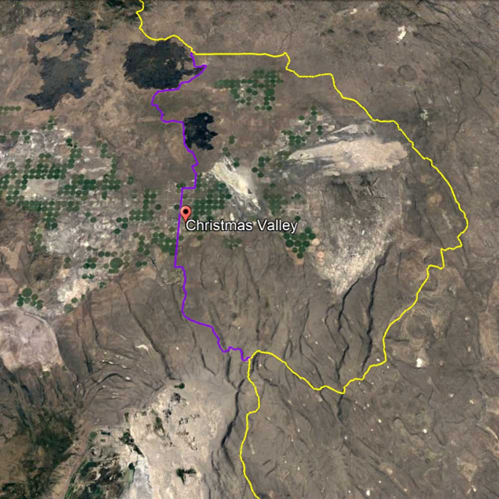
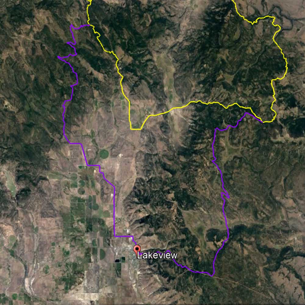
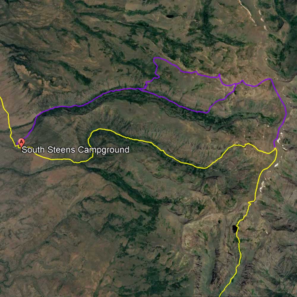
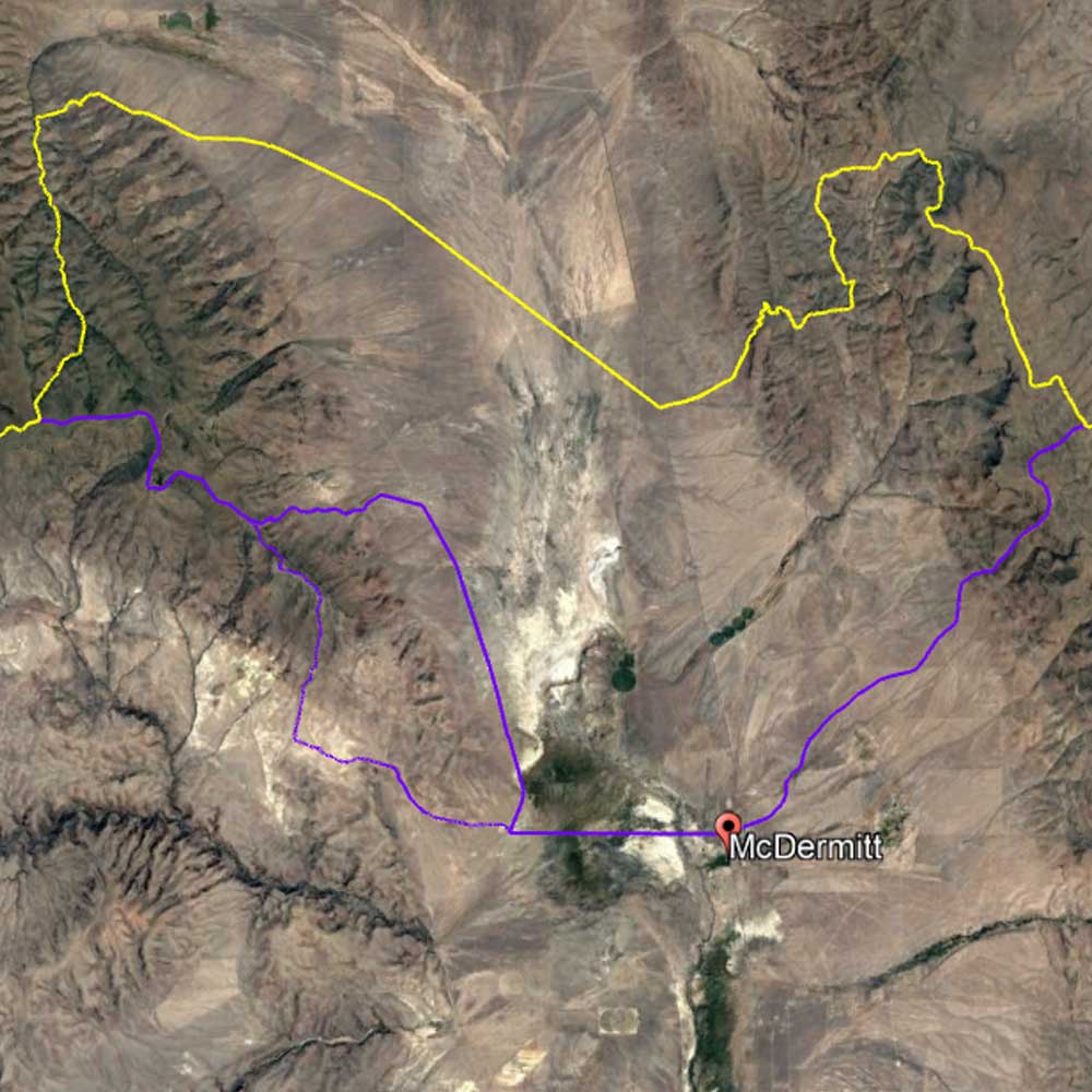
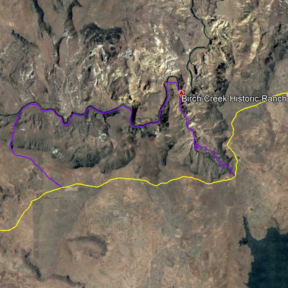
In this post, we are offering up some ideas for multi-day trips you can take along the Oregon Desert Trail route. And, all of these trips are loops — offering that sweet joy of seeing new terrain every step of the way, all without the hassle of car shuttles or having about to worry about how you’ll return to your starting point.

These Oregon Desert Trail materials outline all you need to know to successfully head out on each loop hike:

  • Guidebook
  • Maps (the overview maps linked below should not be used for navigation purposes, please use the ODT maps which offer much more detail)
  • Databook/water chart
  • Town & Services Guide
  • GPS data

fact

Connecting Trails

Connecting Trails

The Oregon Desert Trail ties into two National Recreation Trails: the Fremont National Recreation Trail and Desert Trail.

voices

John Cunningham, ONDA member and volunteer

John Cunningham, ONDA member and volunteer

Restoration is hard slow work. It takes hold, or it doesn’t, in fits and starts. The immensity of the need can be discouraging, but we must carry on. I am so thankful ONDA carries on.

watch

Oregon Desert Trail Map

Oregon Desert Trail Map

And, as always, check current conditions before heading out.

Recreation Resources

Christmas Valley Loop

ODT Sections 3-5 & Christmas Valley Alternate - 107.3 miles

Discover some of the special wonders of the high desert along this hike including Crack in the Ground, the Lost Forest, and the fascinating geological island of the Black Hills Area of Critical Environmental Concern just five miles south of Christmas Valley. Water is almost non-existent on this route, and the navigation challenges of the unmarked cross country sections of the Oregon Desert Trail will give you a real taste for the sagebrush sea.


Make sure to bring a sun umbrella, for there is little to no shade for most of this hike.

Download the overview map

Lakeview Loop

ODT Sections 7-8 & Lakeview Loop Alternate - 67.7 miles

This series of roads and trails are open to hikers, bikers, and horseback riders. Enjoy the beautiful undulating terrain of the Warner Mountains on this loop. Parts of this section tie into two National Recreation Trails: The Fremont NRT and Crane Mountain NRT; and the Oregon Desert Trail also overlaps with the bikepacking route, Oregon Timber Trail. Round out your loop hike or bike with a soak at Hunters Hot Springs, and enjoy a meal at one of Lakeview's numerous restaurants.

Check out Tall Town Bike and Camp for all your gear needs.

Download the overview map

Steens Loop

Section 14 & Little Blitzen Gorge/Nye/Wet Blanket Trails – 20.7/21.4 miles

These loop options are as stunning as they are challenging. By hiking up Big Indian Gorge in Section 14 to waypoint EB023a and taking a left on the Steens Loop Road (following the Steens Loop Alternate track – now in the GPS folder) hikers will wrap around the north side of Little Blitzen Gorge. Two trails take hikers to the lush and scenic canyon below: choose the Wet Blanket Trail to make your loop 20.7 miles, or continue on to the steep Nye Trail for a 21.4 mile loop hike. Follow the creek out to the start (and finish) of your trip.

Snow may make this a tricky hike until late June/July most years. The loop can be hiked in either direction, or maybe both directions!

Download the overview map

McDermitt Loop

ODT Sections 19-20 & McDermitt Alternate - 75.8 miles

From the Oregon/Nevada state line and town of McDermitt, make a loop out of the McDermitt Alternate as it ties into Oregon Desert Trail Sections 19 and 20. The hike will reach scenic heights in the lofty Oregon Canyon Mountains in the west, and travels just north of the Paiute and Shoshone Tribes of the Fort McDermitt Indian Reservation in the east. The small town of McDermitt has just about everything you will need to celebrate a successful loop hike of the area.

Enjoy incredible views into Nevada from numerous spots along the route. A side trip up Flat Top Mountain is a fun addition if you want to channel your inner mountain goat!

Download the overview map

Owyhee Greeley Bar Loop

ODT Section 24 - 22.5 miles

For those interested in starting and ending a loop hike from the historic Birch Creek Ranch, head upstream for a rugged river-side hike (note: most of the route has no trail, and can be challenging with jagged lava rock and thick riparian area vegetation). If you time the hike right you can cross the river for a soak in the Greely Bar Hot Springs and continue past some historic cabins before climbing 1,500 feet up to incredible views of the Owyhee canyon. Follow a faint old road back to the main Oregon Desert Trail and back to Birch Creek Ranch.

Give the Vale BLM district a call to check on road conditions into Birch Creek Ranch before you go.

Download the overview map